- First Name
- Mike
- Joined
- Sep 19, 2022
- Threads
- 8
- Messages
- 59
- Reaction score
- 149
- Location
- Bay Area, CA
- Vehicle(s)
- Outback
- Engine
- 2.0L EcoBoost
- Thread starter
- #1
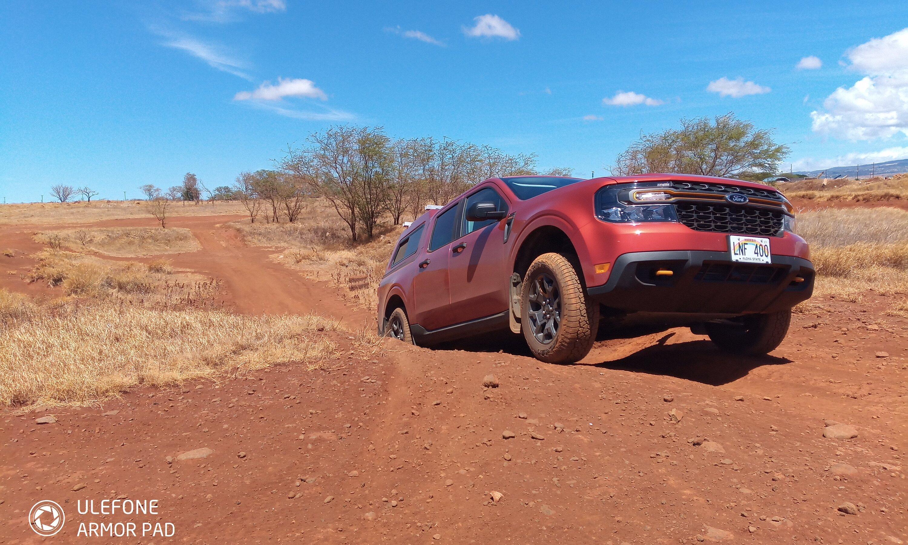
I just drove over 3000 miles through Northern CA, Oregon, Idaho, Montana, NV and back to the Bay Area.
I was specifically looking for tough unpaved roads to test out the Tremor. This was my first real big trip.
In this post I discuss:
1) Davidson Road to Gold Bluffs Beach campground and Fern Creek Canyon trail
2)Road to Crack in the Earth SP, near Christmas Valley, OR
3)Bitterroot-Big Hole Road over the Gibbons Pass, MT
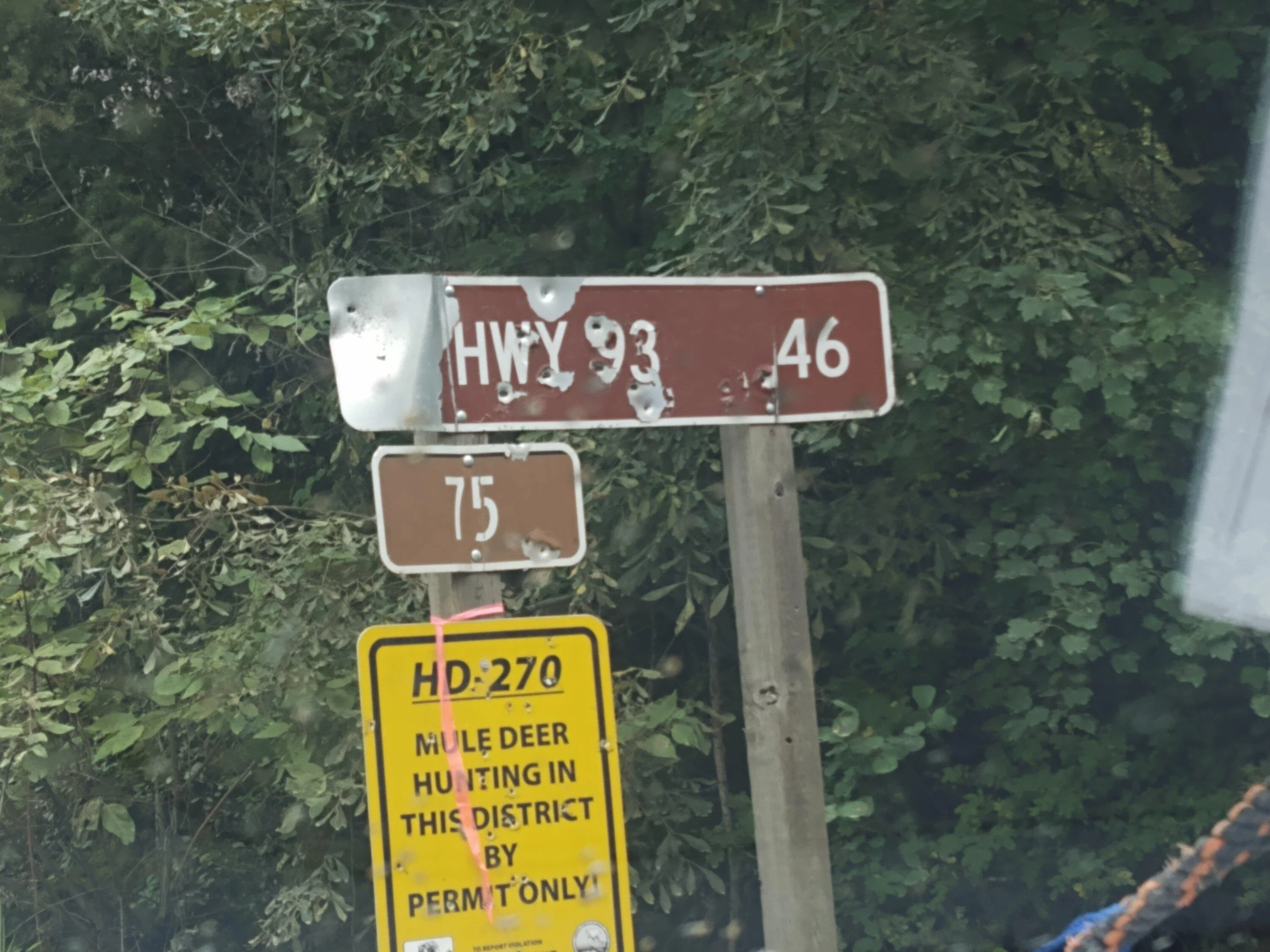
4)Forest Service road #75 from Skalkaho Road (MT SR 38), Hamilton, MT to Rye Creek Lodge and Hwy 97, Darby, MT
5)Flagg Ranch/AShton Road, from Headwaters area of Yellowstone & Grand Teton NPs
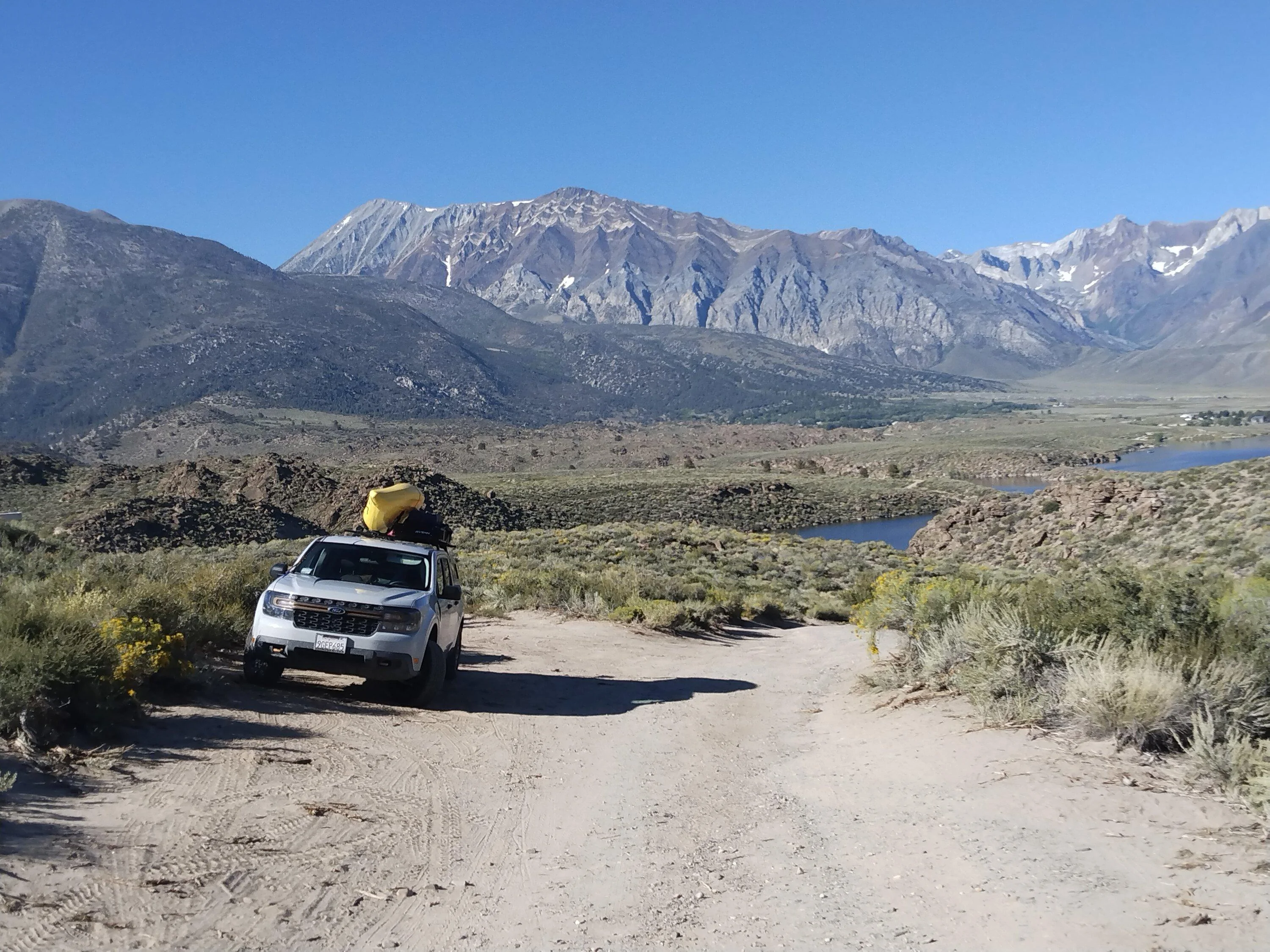
6)Road to Crowley Lake Columns off hwy 395 near Mammoth Lakes, CA
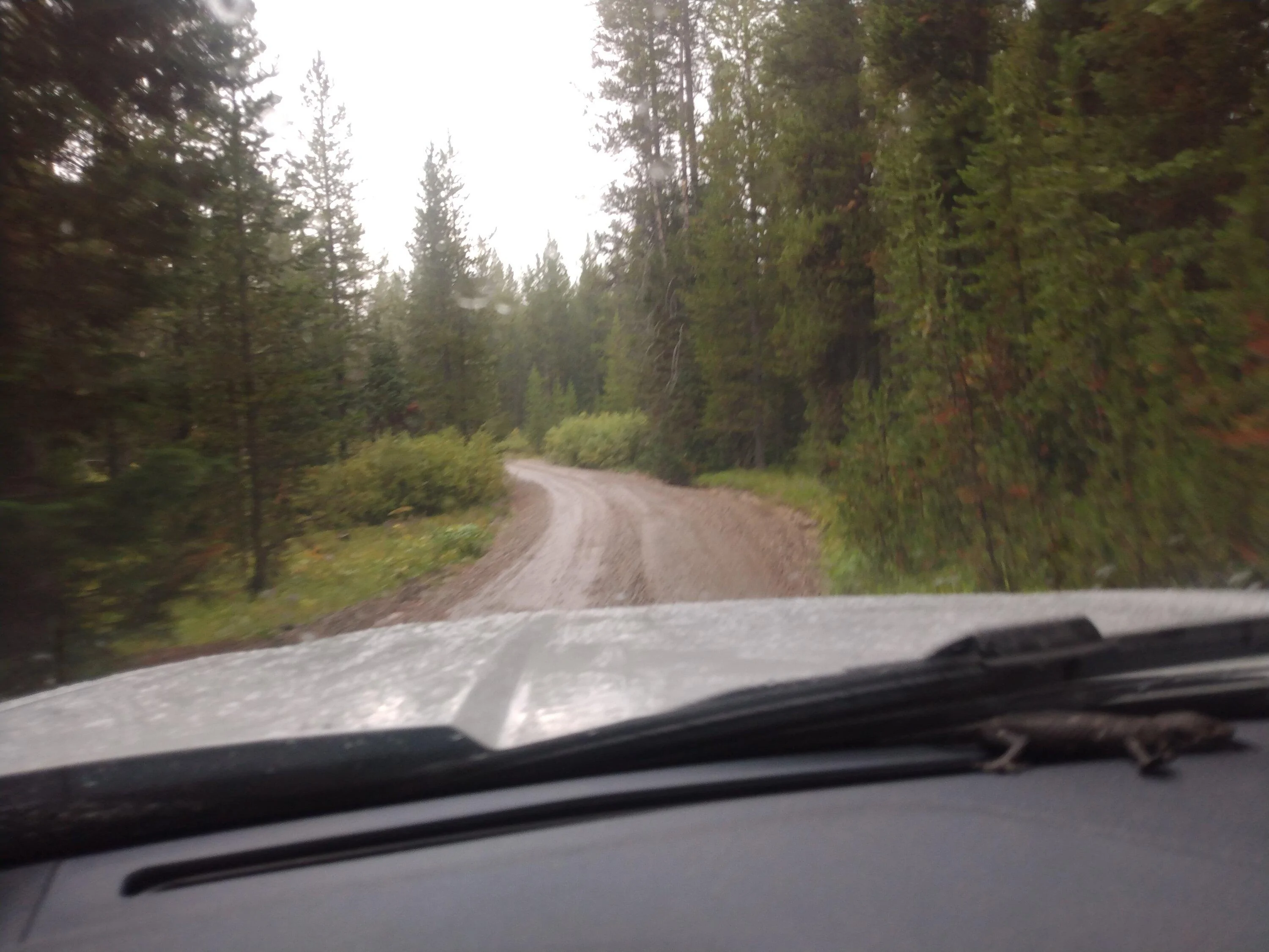
1) this was a well maintained gravel road. very curvy and dusty, but easy for anything with AWD.
There were two creeks to drive through between the campground and the Fern Creek TH, but not a problem for the Tremor.
Water flows were not that high in August,
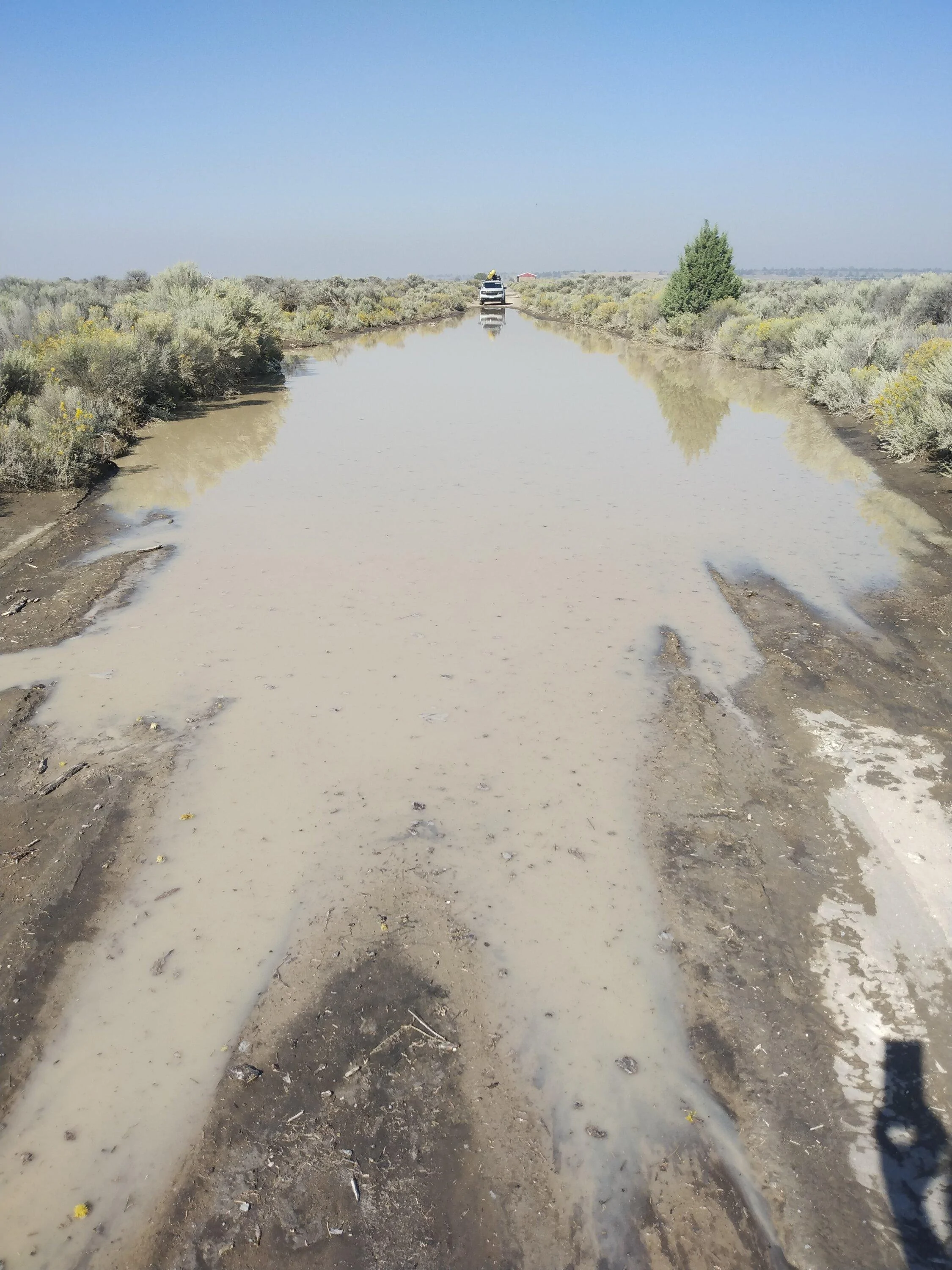
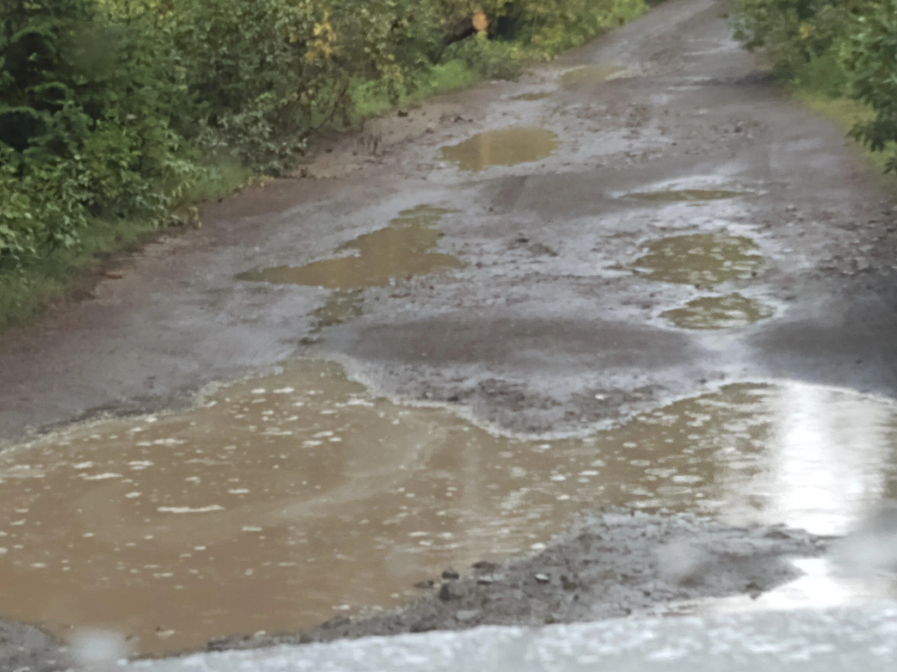
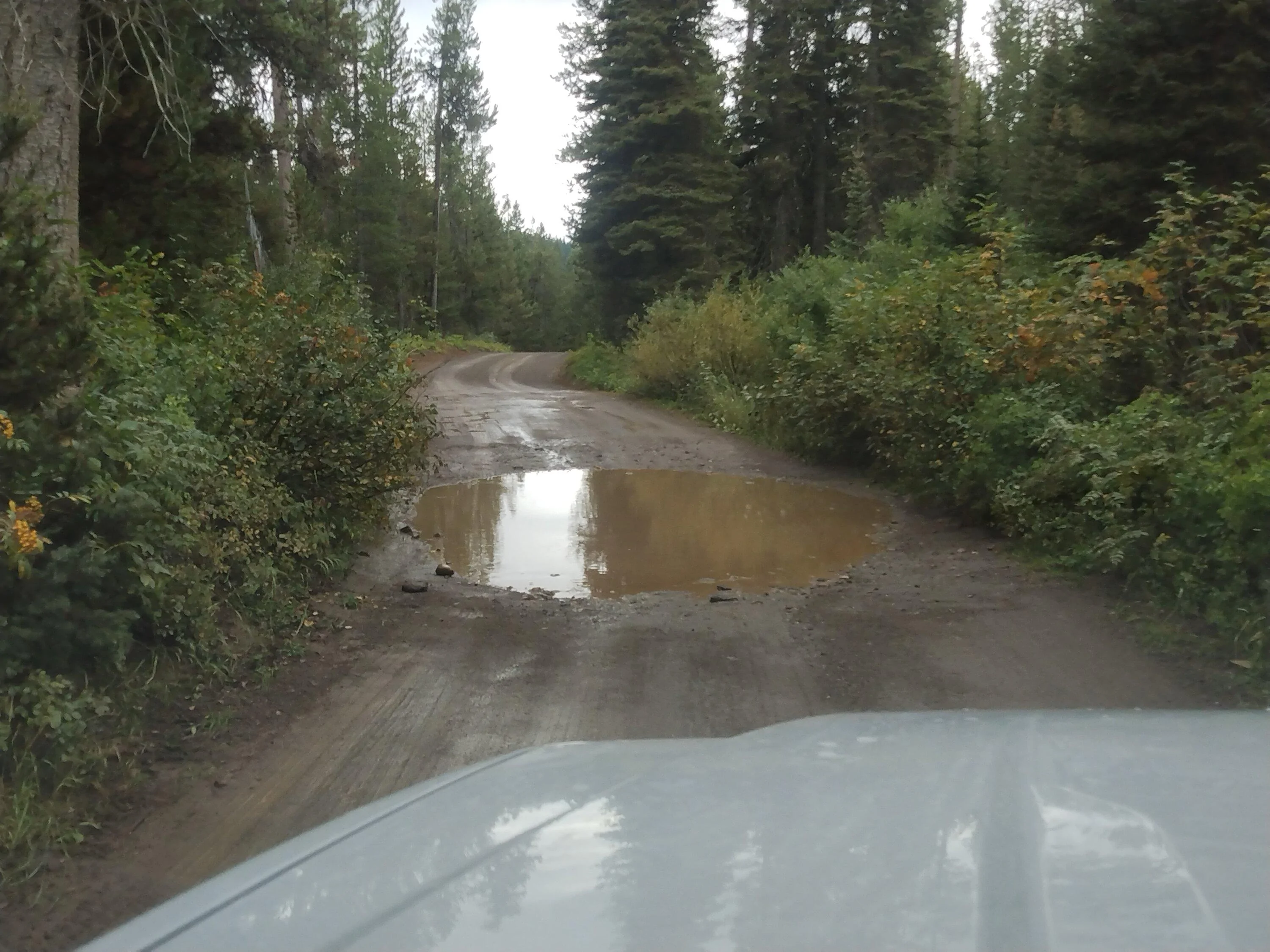
2)This road was a mess. I'm not sure if it was Ag overflow or if a monsoon went thru earlier, but the road Google directed me to,
Raven Ridge Road, was flooded, one large lake after another. I went down about half of it, until I hit one that was about 35' to 40'
long. I went for it, keeping my passenger side tires up on the berm, thinking if my driver side started to slip, it would be able to give
more torque to them. I walked this entire thing and measured the depth with a stick of firewood. It was about 8-ten inches, including
mud at the bottom. After clearing that, I turned around, did it again in the same fashion. Then went around the block, which was
also flooded intermittently but not as bad, and made it to Lava Crater Road, which takes you up to a pretty cool rock formation.
Lava Crater Road has a steep, rough ascent initially, but after that, it's in pretty good shape. Tremor handled it all with aplomb. A little
slippage going through the flooding but it gripped right in and made it through them
BLM.gov/visit/crack-in-the-ground
3)Bitterroot- Big Hole Road over Gibbons Pass
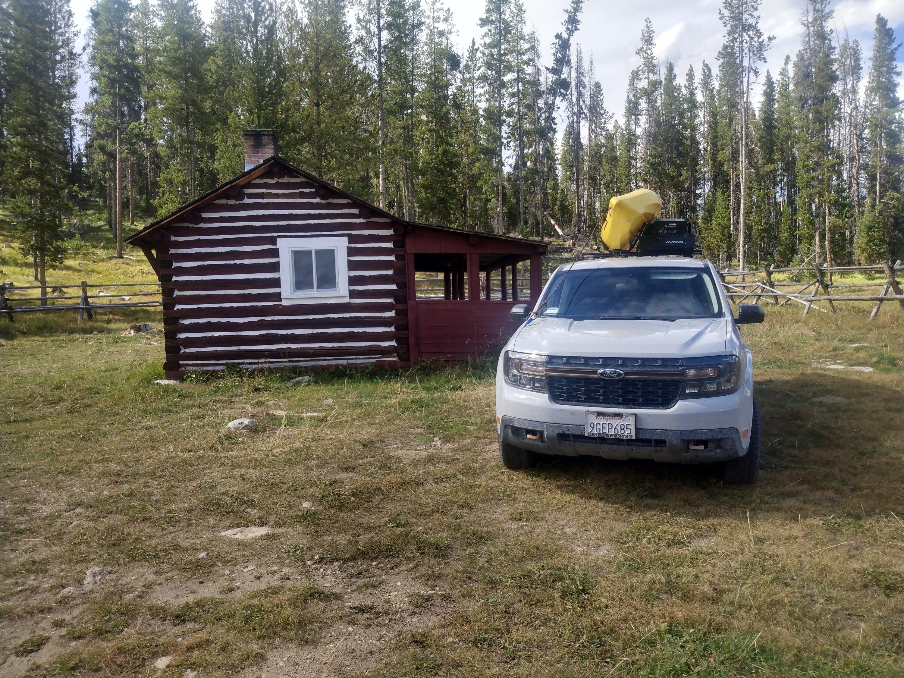
I stayed at the Hogan Cabin while checking this out. Managed by the Wisdom, MT office of the FS, it's secluded and perfectly located.
You can get to the cabin off Hwy 43, look for signs for FS#106. Left at 106A. There's a sign for the cabin. Unpaved but in great shape.
You can also take FS#1260 from Chief Joseph Pass, go about 7-8 miles, right onto 106, right onto 106A to cabin.
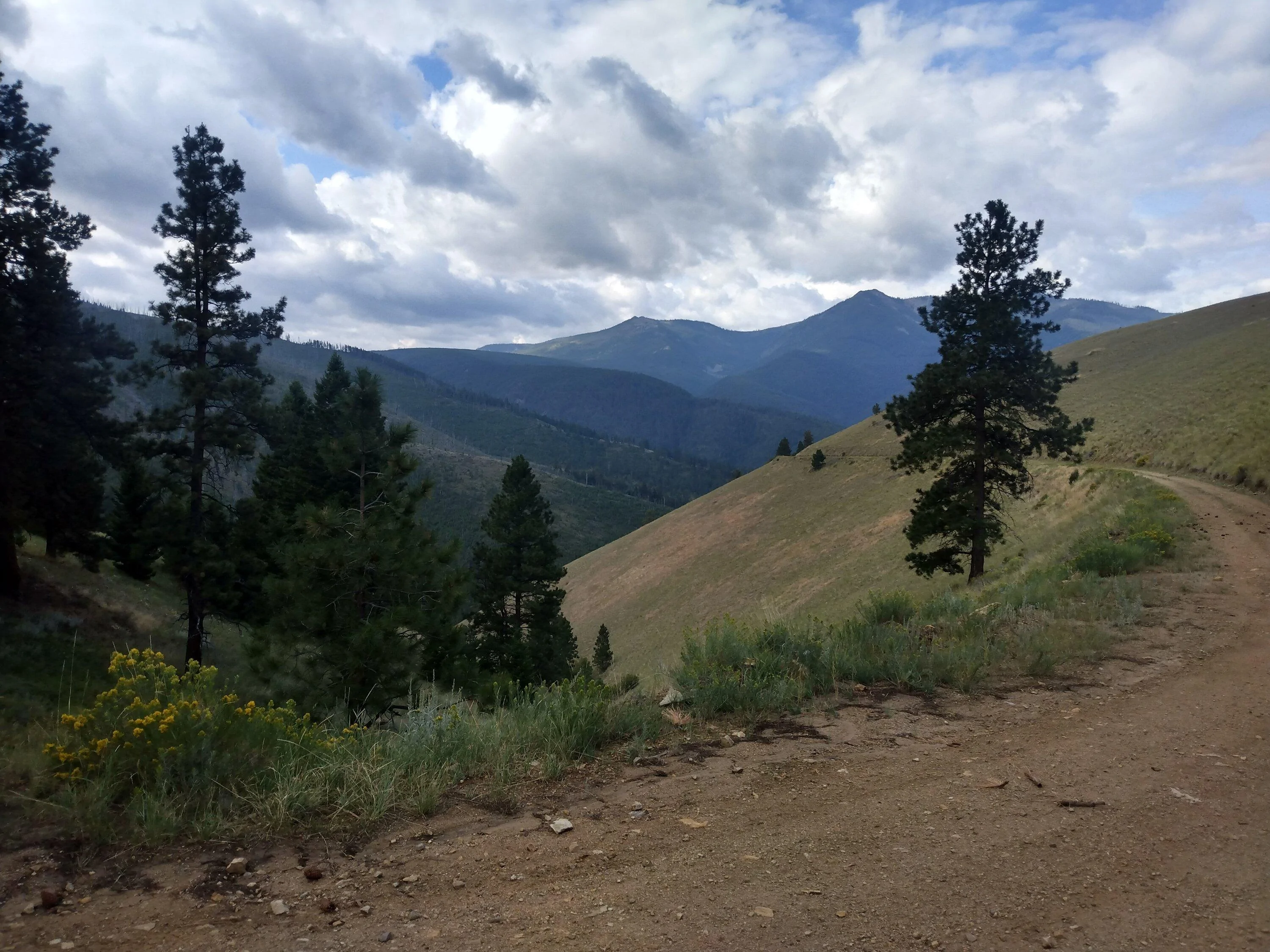
I started out the next day to drive the toughest part of this road. From Gibbons Pass down to the Sula Ranger Station, just off hwy 97. After a mile, the road was blocked with fallen trees. Two of them were small enough to cut and move out of the way, but the larger one was more difficult. I cut it in half, and used a cinch strap attached to my front hook to pull it out of the way. The road was too narrow to turn around. Uphill traffic has the right of way, so if you do this, start at Sula, its all up hill, but it minimizes your chances of having to back up. This is one steep and narrow road. Pretty rough, and not well maintained but fun. Look for a Chief Joseph Pass Multi Use Trail topo map put out by the Bitterroot Cross Country Ski Club.


4) For this one, a map is a must. Head over to the Bitterroot FS office on N. First ST, in Hamilton, and pickup the Motor Vehicle Use Map
Bitterroot National Forest, Stevensville/Darby Ranger District. FS#75 is a 40-odd mile loop through beautiful back country but not very signed at all.
Road was deeply rutted from snow melt or recent rains. I'm not talking washboard, I'm talking ruts. It took me about 4 hours to make the loop,
trying to check each sign or intersection against the map. And I still made a wrong turn. I saw two other trucks; very sparsely populated. Make sure you have plenty of gas and maybe a spare spare tire. Montana is unforgiving and weather can change in a moments notice. MT SR # 38/Skalkaho Road, is another AWESOME road for the adventurous. I didn't drive it this time but have in the past. It connects Hamilton with Philipsburg and Anaconda.
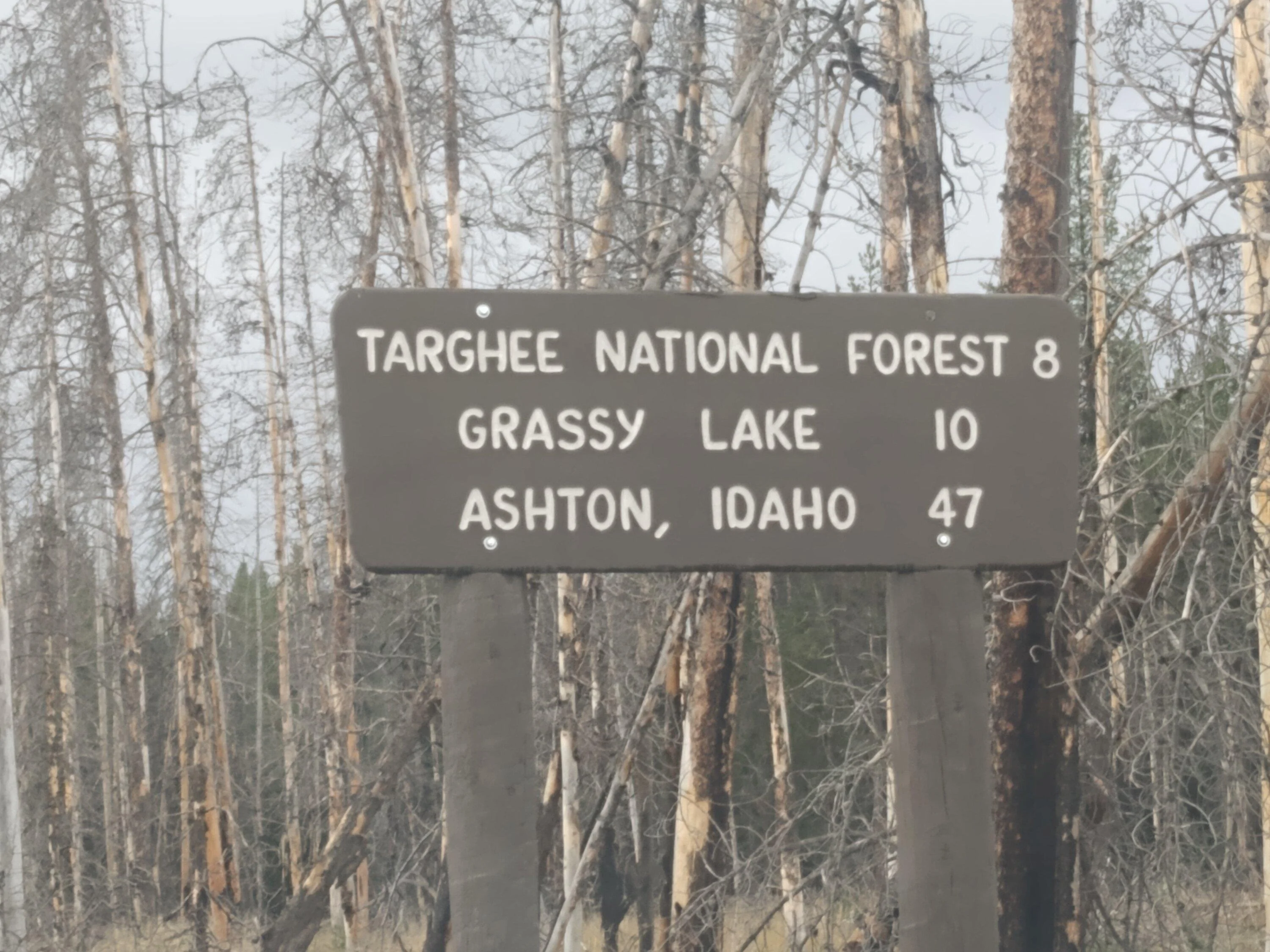
5) Flagg Ranch to Ashton, Idaho road. This begins in Headwaters area of the national parks, south of Yellowstone but north of the Grand Tetons, along
the Rockefeller Parkway. It is paved for a bit then gravel, past some very nice, I believe, first come-first served campsites along the river. Once you leave those behind, it a rougher road. I don't know if it was a tough winter, but the road was rough with mud, ruts and flooding. It was pouring when I did this and was slow going. You go by a reservoir and another bookable FS cabin before coming out into farmland about 10 miles from Ashton. I went pretty slow and the Tremor handle it all great.
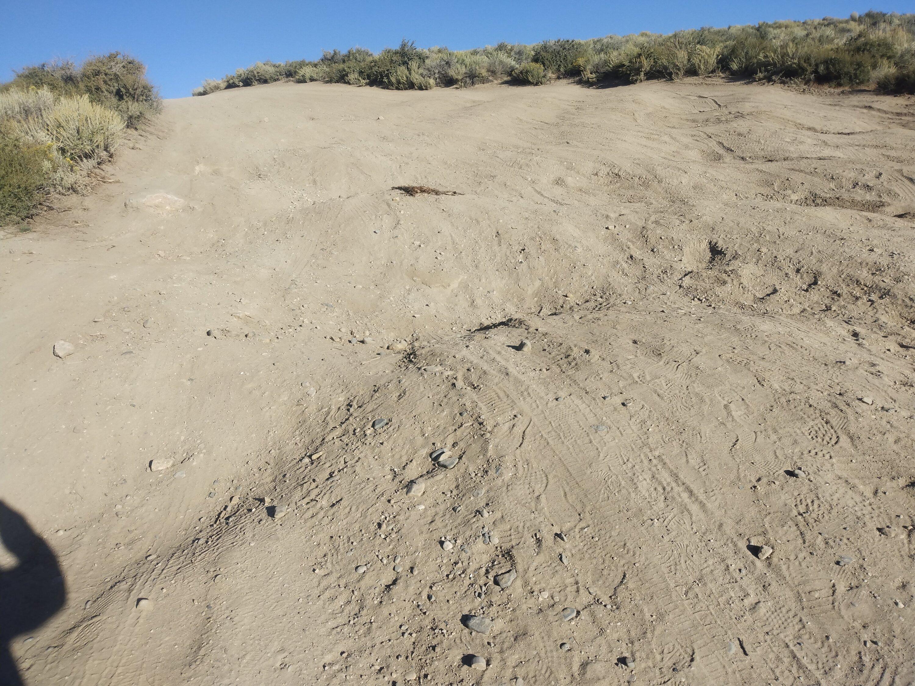
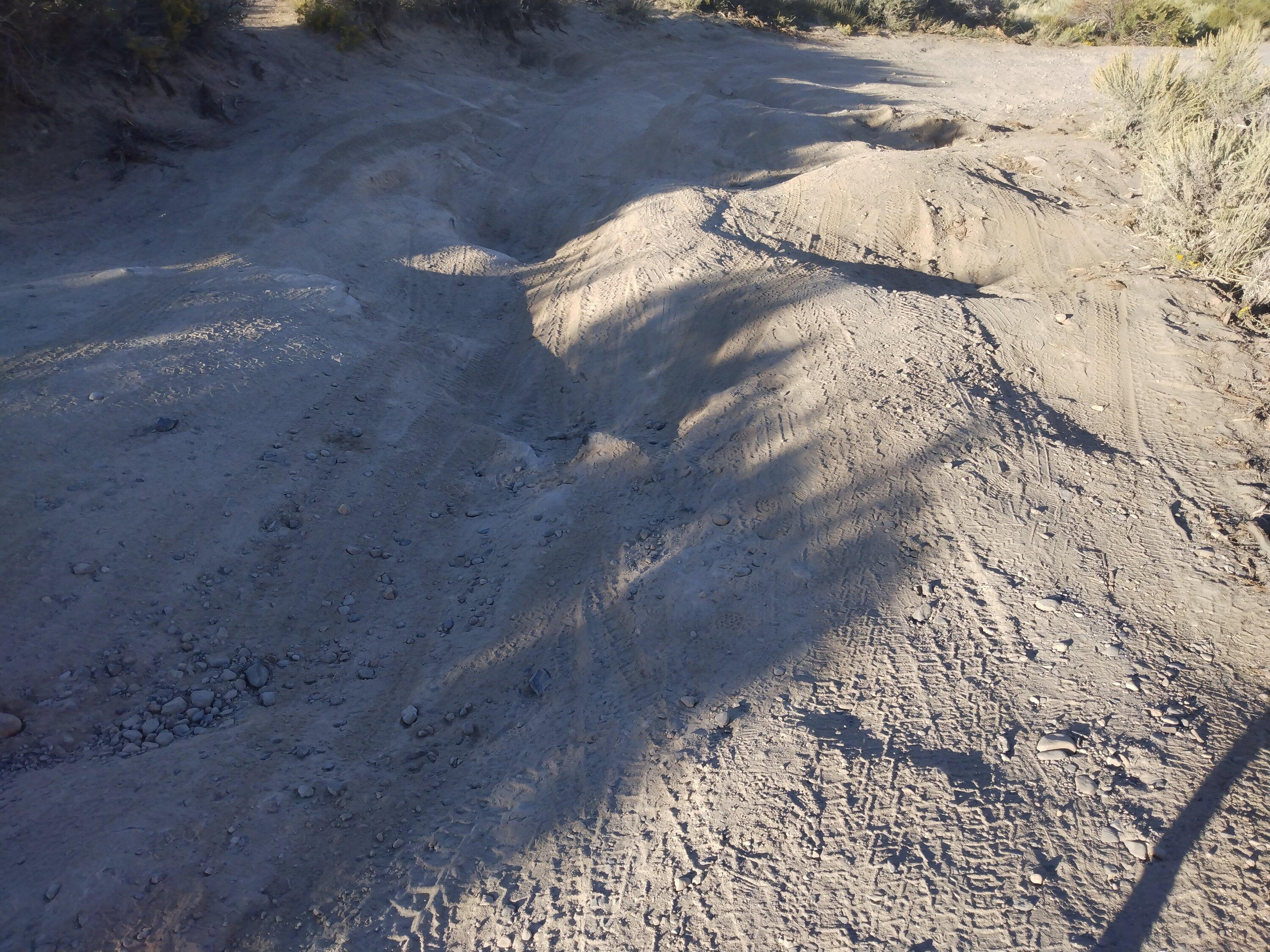
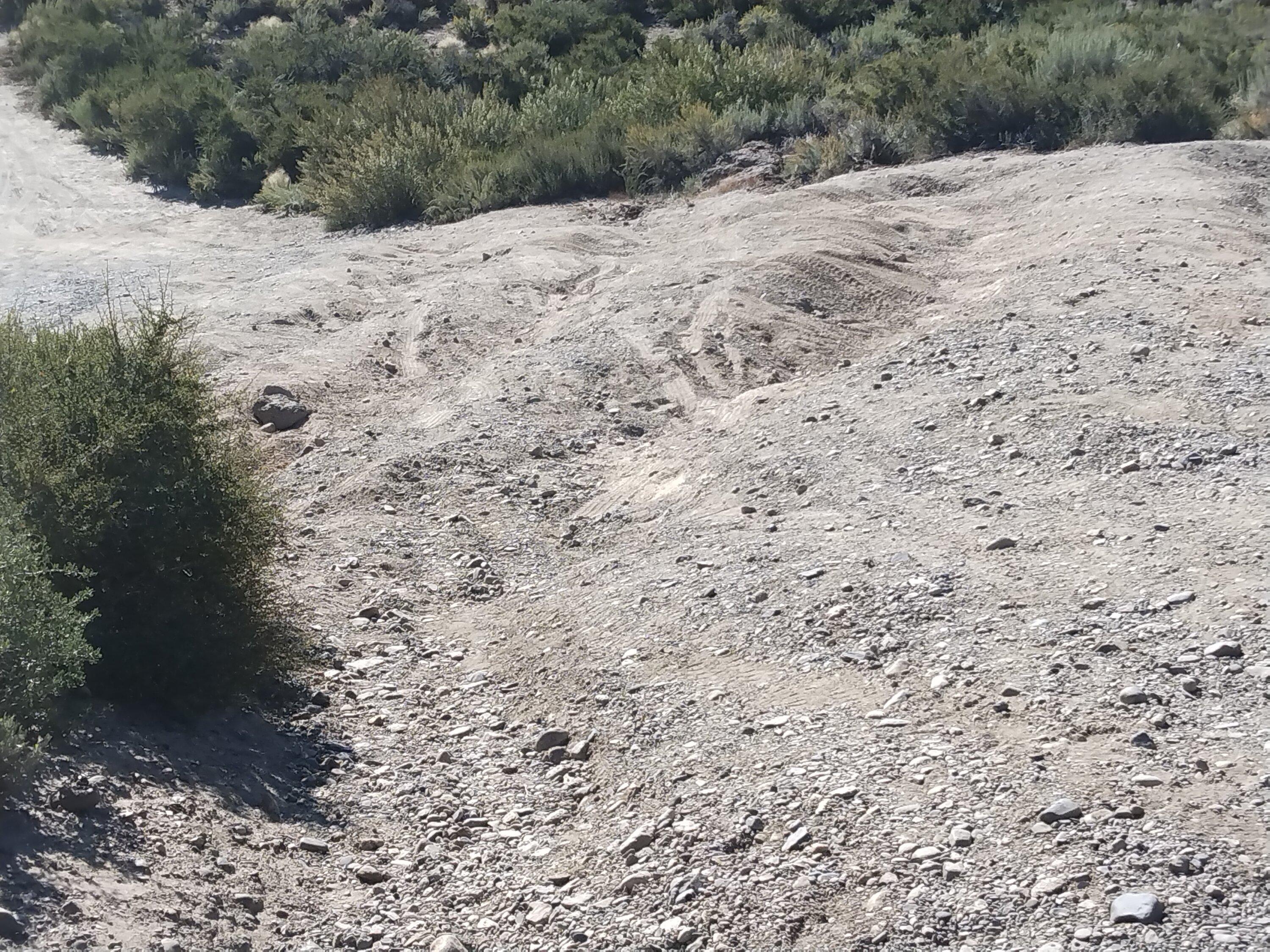
5) Coming from Mammoth, you take the exit after the Marina, go over the dam and take the first tight hairpin left turn. The first half a mile or so is OK but then you descend into a saddle. The road down is rough, dirt and deeply rutted. The Tremor made it down and back up. But once at the bottom of the saddle,
we were faced with a tough ascent up a probably 30% grade that was also DEEPLY rutted. I tried a couple of different times, up different routes, but just
couldn't get it done. It was not a question of traction, I have the stock Tremor Wildpeak A/Ts, and they grip great, no slippage, but I ran out of clearance. The pics of this don't do it justice. It was steep and rutted. The only thing the Tremor couldn't do on the entire trip. I had my bicycle with me, so biked the last two miles to see the Crowley Columns, an unusual rock formation along the edge of the lake.
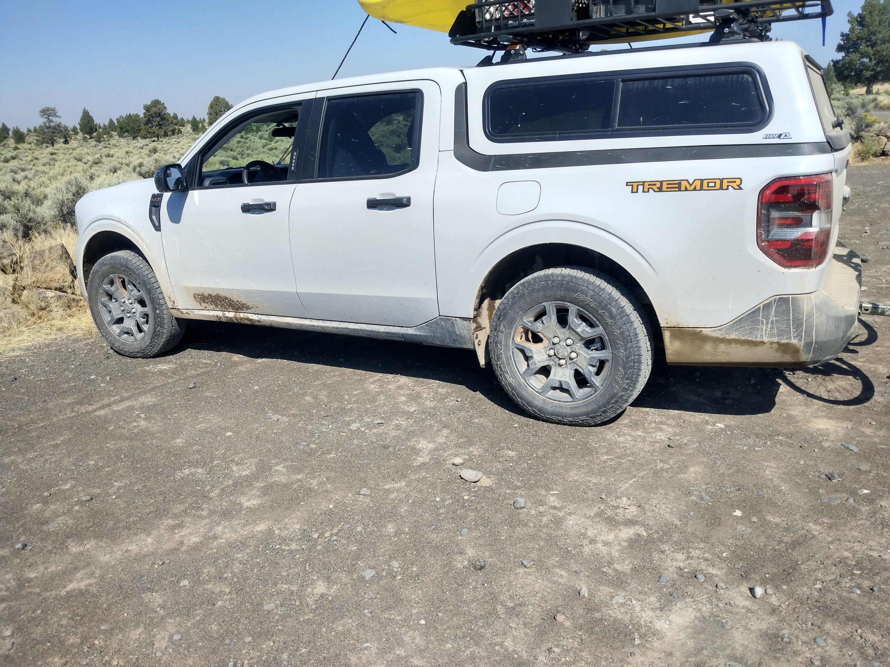
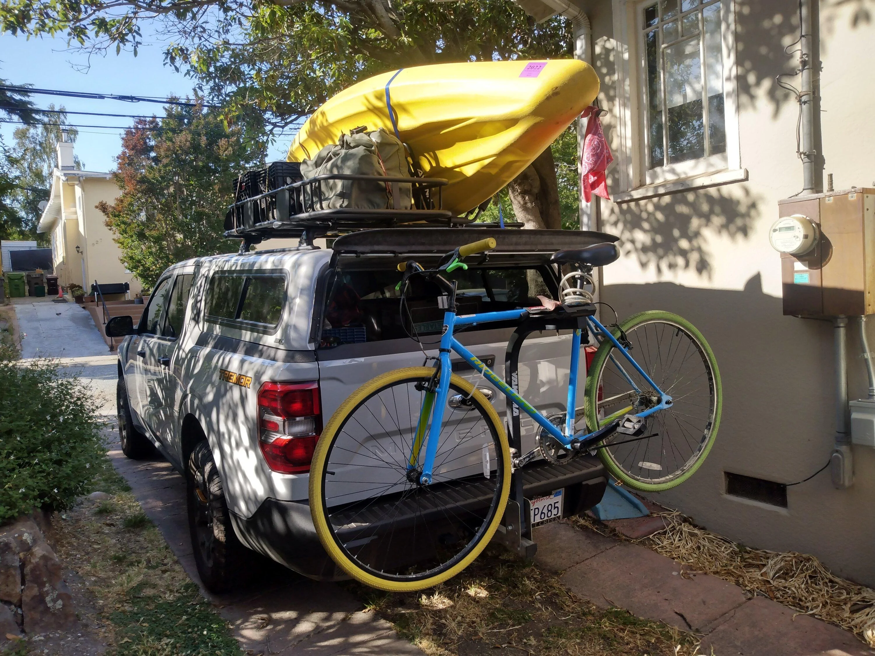
I had a great trip. Tried to stay off interstates and got about 23 mpg with a bike off the back and kayak on the roof. lmk if you have any questions.
Have fun but be safe out there. Also, please remember to leave no trace. You are responsible for knowing the rules of the various areas outlined above.
Plan on trips being tougher and taking longer. Have extra gas and water. And let someone know where you're headed and when you'll be back
I was specifically looking for tough unpaved roads to test out the Tremor. This was my first real big trip.
In this post I discuss:
1) Davidson Road to Gold Bluffs Beach campground and Fern Creek Canyon trail
2)Road to Crack in the Earth SP, near Christmas Valley, OR
3)Bitterroot-Big Hole Road over the Gibbons Pass, MT
4)Forest Service road #75 from Skalkaho Road (MT SR 38), Hamilton, MT to Rye Creek Lodge and Hwy 97, Darby, MT
5)Flagg Ranch/AShton Road, from Headwaters area of Yellowstone & Grand Teton NPs
6)Road to Crowley Lake Columns off hwy 395 near Mammoth Lakes, CA
1) this was a well maintained gravel road. very curvy and dusty, but easy for anything with AWD.
There were two creeks to drive through between the campground and the Fern Creek TH, but not a problem for the Tremor.
Water flows were not that high in August,
2)This road was a mess. I'm not sure if it was Ag overflow or if a monsoon went thru earlier, but the road Google directed me to,
Raven Ridge Road, was flooded, one large lake after another. I went down about half of it, until I hit one that was about 35' to 40'
long. I went for it, keeping my passenger side tires up on the berm, thinking if my driver side started to slip, it would be able to give
more torque to them. I walked this entire thing and measured the depth with a stick of firewood. It was about 8-ten inches, including
mud at the bottom. After clearing that, I turned around, did it again in the same fashion. Then went around the block, which was
also flooded intermittently but not as bad, and made it to Lava Crater Road, which takes you up to a pretty cool rock formation.
Lava Crater Road has a steep, rough ascent initially, but after that, it's in pretty good shape. Tremor handled it all with aplomb. A little
slippage going through the flooding but it gripped right in and made it through them
BLM.gov/visit/crack-in-the-ground
3)Bitterroot- Big Hole Road over Gibbons Pass
I stayed at the Hogan Cabin while checking this out. Managed by the Wisdom, MT office of the FS, it's secluded and perfectly located.
You can get to the cabin off Hwy 43, look for signs for FS#106. Left at 106A. There's a sign for the cabin. Unpaved but in great shape.
You can also take FS#1260 from Chief Joseph Pass, go about 7-8 miles, right onto 106, right onto 106A to cabin.
I started out the next day to drive the toughest part of this road. From Gibbons Pass down to the Sula Ranger Station, just off hwy 97. After a mile, the road was blocked with fallen trees. Two of them were small enough to cut and move out of the way, but the larger one was more difficult. I cut it in half, and used a cinch strap attached to my front hook to pull it out of the way. The road was too narrow to turn around. Uphill traffic has the right of way, so if you do this, start at Sula, its all up hill, but it minimizes your chances of having to back up. This is one steep and narrow road. Pretty rough, and not well maintained but fun. Look for a Chief Joseph Pass Multi Use Trail topo map put out by the Bitterroot Cross Country Ski Club.
4) For this one, a map is a must. Head over to the Bitterroot FS office on N. First ST, in Hamilton, and pickup the Motor Vehicle Use Map
Bitterroot National Forest, Stevensville/Darby Ranger District. FS#75 is a 40-odd mile loop through beautiful back country but not very signed at all.
Road was deeply rutted from snow melt or recent rains. I'm not talking washboard, I'm talking ruts. It took me about 4 hours to make the loop,
trying to check each sign or intersection against the map. And I still made a wrong turn. I saw two other trucks; very sparsely populated. Make sure you have plenty of gas and maybe a spare spare tire. Montana is unforgiving and weather can change in a moments notice. MT SR # 38/Skalkaho Road, is another AWESOME road for the adventurous. I didn't drive it this time but have in the past. It connects Hamilton with Philipsburg and Anaconda.
5) Flagg Ranch to Ashton, Idaho road. This begins in Headwaters area of the national parks, south of Yellowstone but north of the Grand Tetons, along
the Rockefeller Parkway. It is paved for a bit then gravel, past some very nice, I believe, first come-first served campsites along the river. Once you leave those behind, it a rougher road. I don't know if it was a tough winter, but the road was rough with mud, ruts and flooding. It was pouring when I did this and was slow going. You go by a reservoir and another bookable FS cabin before coming out into farmland about 10 miles from Ashton. I went pretty slow and the Tremor handle it all great.
5) Coming from Mammoth, you take the exit after the Marina, go over the dam and take the first tight hairpin left turn. The first half a mile or so is OK but then you descend into a saddle. The road down is rough, dirt and deeply rutted. The Tremor made it down and back up. But once at the bottom of the saddle,
we were faced with a tough ascent up a probably 30% grade that was also DEEPLY rutted. I tried a couple of different times, up different routes, but just
couldn't get it done. It was not a question of traction, I have the stock Tremor Wildpeak A/Ts, and they grip great, no slippage, but I ran out of clearance. The pics of this don't do it justice. It was steep and rutted. The only thing the Tremor couldn't do on the entire trip. I had my bicycle with me, so biked the last two miles to see the Crowley Columns, an unusual rock formation along the edge of the lake.
I had a great trip. Tried to stay off interstates and got about 23 mpg with a bike off the back and kayak on the roof. lmk if you have any questions.
Have fun but be safe out there. Also, please remember to leave no trace. You are responsible for knowing the rules of the various areas outlined above.
Plan on trips being tougher and taking longer. Have extra gas and water. And let someone know where you're headed and when you'll be back
Sponsored