
- First Name
- Richie
- Joined
- Mar 12, 2026
- Threads
- 7
- Messages
- 493
- Reaction score
- 798
- Location
- Pennsylvania
- Vehicle(s)
- 2023 Ford Maverick Lariat Cyber Orange
- Engine
- 2.5L Hybrid
- Thread starter
- #46
Sponsored
I passed over many parks I have been to before on this trip. There is a route that shows the most mileage efficient way to get all of the National Parks in the ‘Lower 48’ in one run! Keep travelling too!!!Nice! On my bucket list. I've visited many of the parks but never in one trip. Keep it up.

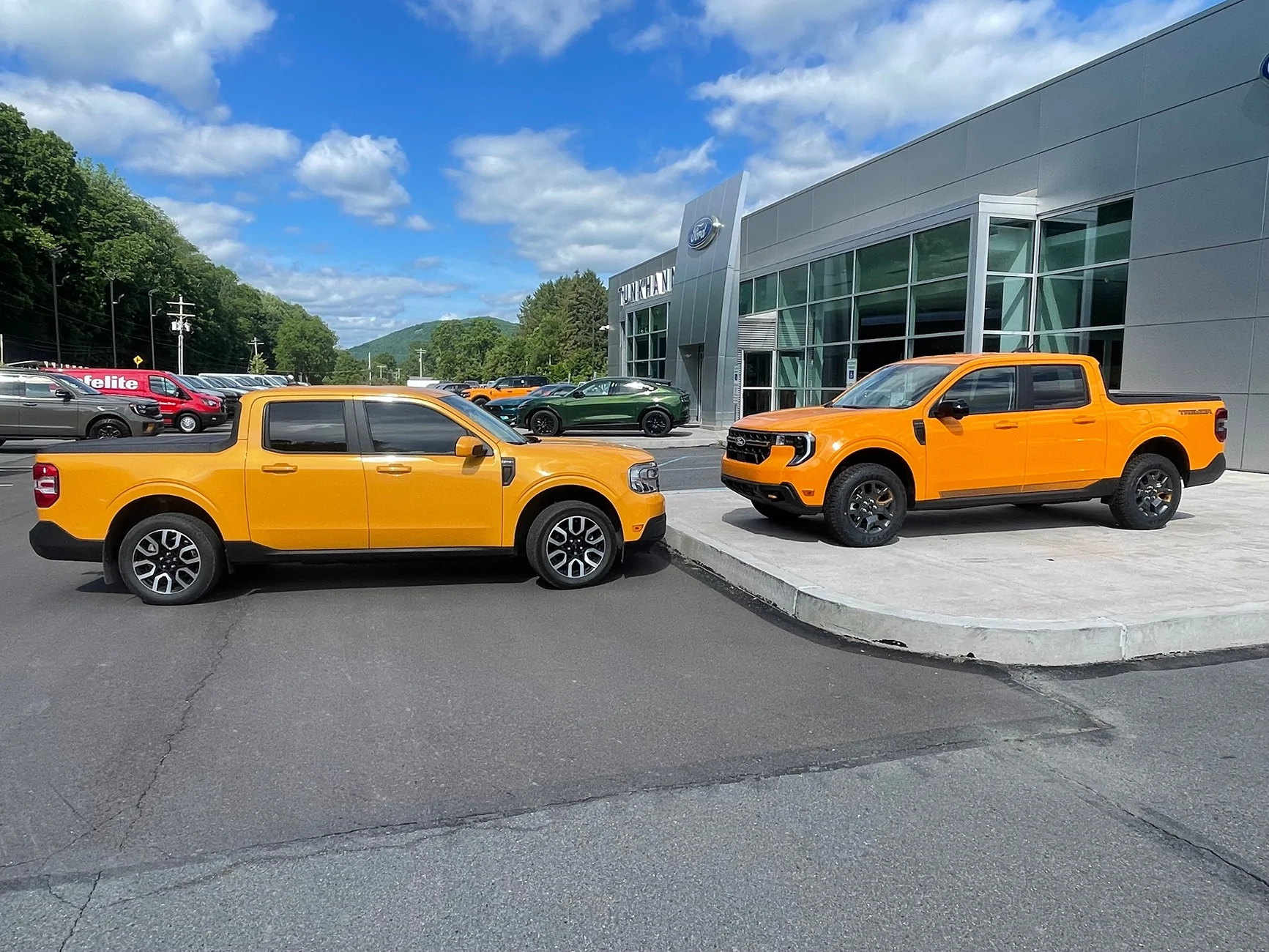
Is that Cyber, or the ‘new’ orange?? Beautiful!!
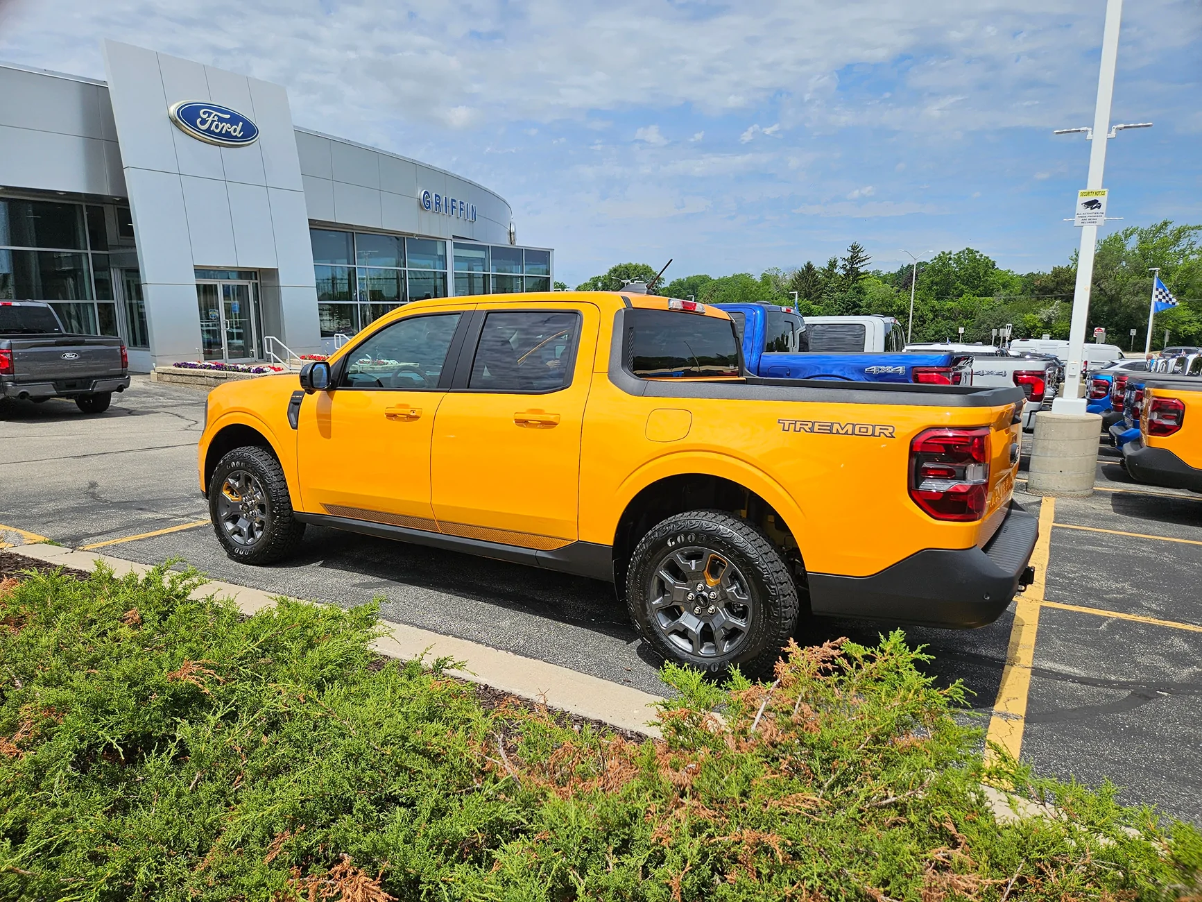

Orange Fury Metallic, Tremor color. Look just like Cyber on the lot,
That is an XLT in Cyber behind and far right, just the rear end in shot.
That is not a bucket list!! That is a ‘Barrel List!’Great trip...thanks for sharing - I do something similar...
Listed below with GPS coordinates.
Trailer is interesting - A local company make an identical trailer - base trailer ranges
from $3,500 to $4,000 depending on shelving and if A/C unit is installed. Weighs in
at around 850 lbs.
The Big Bucket Travel List of Places to See
AZ- Barringer Crater, east of Flagstaff, AZ - 35.02773 111.02219
AZ- Tuson - Mount Lemmon in Santa Catalina Mountains -
AZ- Grand Canyon National Park - 36.28239 112.36437
AZ- Sedona, AZ city - 34.86102 111.81729
AZ- Hwy 180 from Grand Canyon to Flagstaff 36.26726 112.35351
AZ-Tombstone, Arizona - 31.71490 110.06981
AZ - Vermilon Cliffs - 36.88879 111.82831
NV-Death Valley National Park - 36.53526 117.09267
NV-Rhyolite Ghost Town - 36.89039 116.82652
NV-Red Rock Canyon – Sedona 35.38590 117.96219
NV-Valley of Fire State Park (50 miles North of Las Vegas) - 36.47617 114.53839
NV-Fly Geyser - 40.85947 119.33191
NV-Hoover Dam - 36.01632 114.73957
CA-17 Mile Drive - Pebble Beach - 36.60370 121.94526
CA-Sea to Sky highway, from Vancouver to Whistler Canada - 49.46063 123.23654
CA-Salton Sea/Slab City/Salvation Mountain - Calpatria, CA - 33.28184 115.96819
CA-Yosemite Cloud's Rest – 37.76895 119.48928
CA-Yosemite National Park – 37.86647 119.54565
CA-Redwood National Park – 44.40786 124.04790
CA-Mud Pots – Niland - 33.22283 115.59538
CA-Sequoia National Park - 36.49179 118.56648
CA-Sierra Nevada Mountains – Tioga_Pass - 37.66083 119.13928
CA-San Luis Opismo to Morrow Bay – Motel – 35.26990 120.67229
CA-Hearst's Castle - 35.65066 121.18626
CA-Alabama Hills - Lone Pine – 36.61027 118.10017
CA-Death Valley – 36.64518 117.03562
CA-Joshua Tree NP – 34.13538 116.30898
CA-Mojave National Preserve (needs spare gas) - 35.02195 115.48304
NM-Lincoln National Forest - 32.95211 105.44154
NM-Carlsbad Caverns National Park - 32.18152 104.54220
NM-Chama, New Mexico (Large elk population) - 36.89397 106.58263
NM-Valle Vadal (Carson National Forest) population of Elk in US - 36.7575 105.27019
NM-Royal Gorge bridge (amazing) - 38.46146 105.32506
NM-Whitesands Missile Range, white sand dunes - 32.78334 106.18303
SD-Badlands National Park - 43.85733 102.33490
SD-Black Hills - 44.01657 103.85651
SD-Mount Rushmore - 43.88042 103.45376
CO-Alpine Loop - 38.03428 107.30462
CO-Mesa Verde National Park - 37.18378 108.48818
CO-Telluride - 37.93696 107.81266
CO-Estes Park (Elk) - 40.37846 105.51765
CO-Rocky Mountain National Park - 40.34458 105.67943
CO-Glenwood Springs, Garden of the Gods, Pikes Peak, Flatiron, Gunnison, Steamboat Springs - 39.54770 107.32527
CO-Great Sand Dunes National Park – 37.76476 105.62289
CO-Black Canyon of the Gunnison Nat Pk-(go to bottom on narrow paved road) -38.57722 107.74135
GA-Stone Mountain
GA-City of Savannah (RiverStreet - walk street, at night)
GA-Tybee Island -
GA-Cumberland Island (have to take a boat ride to reach island to see horses)
NH-Flume Gorge, Franconia State Park - New Hampshire
NH-Mt Washington - New Hampshire
NH-Kangamangus Hwy through the White Mountains
NC-Blue Ridge Parkway (NC and TN) http://en.wikipedia.org/wiki/Blue_Ridge_Parkway
NC-"The Dragon/Deals Gap" US129 (TN, NC)
NC-The Outer Banks of North Carolina (50-80+ miles)
NC-Nantahala National Forest – NC
MT-Beartooth Highway - 44.97520 109.45572
MT-Glacier National Park (Going to the Sun Hwy) 48.76034 113.78733
MT-Upper Missouri Breaks (very hard to get to, dirt)
MT-Charles M. Russell Wildlife Refuse 47.70005 107.16723
MT-Lemhi Pass (MT and Idaho) 44.97530 113.44531
MT-Bannock (western ghost town) 44.81526 113.91493
ID-Gibbons Pass (ID and Montana) 45.74683 11391493
ID-From Lolo, MT west - Hwy 12 (east and west)
ID-Lolo Motoring Highway (122 miles off-road – very off-road) ??
ID-North Fork, North Fork of the Salmon Road (dirt) to the dead end (34 miles)
ID-Hells Canyon NRA – 44.97370 116.85817
OR-Crater Lake – 42.93213 122.16716
OR-Tillamook Air Museum - blimp hanger on the Pacific - 45.42088 123.80432
OR-Painted Hills; Mitchell - 44.66235 120.27348
OR-John Day River/Deschutes River, Painted Hills
OR-Crater Lake National Park - 42.91112 122.13795
OR-Lassen Volcanic National Park - 40.49532 121.42532
OR-Hells Canyon Scenic By-Way 44.97443 116.85924
OR-Cape Perpetua, Oregon -
OR-Vista House View overlook of Columbia River - 45.54180 122.24677
OR-Fort Clatsop(Astoria)Winter camp replica of Lewis & Clark fort - 46.13478 123.88037
OR-Cannon Beach – (Hay Stack Rock) - 45.89123 123.96123
OR-Hat Rock – Oregon side of Columbia River – 45.91761 119.17046
NW-The Cascades - BC, WA, OR, CA
WA/OR-Lewis and Clark State Park on the Columbia River
WA-The Hwy from Asotin Washington to Enterprise Oregon (Hwy 3) is a great ride.
WA-Mount Rainier National Park - 46-81619 121.70672
WA-Mount St Helen - 46.2624 122.25838
WA/OR-Columbia River is state line (Oregon & Washington) - 46.22065 109.02926
WA- Cape Disappointment and Lighthouse - 46.29968 124.06540
WA-Dayton, WA Patit Creek L&C Campsite memorial – 46.34556 117.93568
WA – Dayton, Patit Creek L&C Campsite – 46.34584 117.93593
UT-Arches/Canyonlands National Parks Moab - 38.61669 109.61946
UT-Cisco to Arches (ghost town) Hwy 128-favorite road (20 miles) - 38.97085 109.32111
UT-Goblin Valley State Park – 38.56999 110.70721
UT-San Rafaell Swell (unique curvey road) - 38.82472 110.67704
UT-Lake Canyon (needs full day and hiking) - 40.96082 111.66850
UT-Capital Reef National Park (needs full day and hiking) (big) 38.29165 111.26169
UT- Kanab – 37.04330 112.52445
UT- Gunsmoke Movie Set - 37.11827 112.38396
UT- Moki Dugway (on way to Monument Valley; scary) - 37.27589 109.93835
UT- Monument Valley (UT and AZ) - 37.00560 110.17180
UT-Valley of the Gods – (East Entrance) 37.23517 – 109.81346
UT- Canyons of the Escalante – 37.50821 111.51490
UT-Zion National Park (needs 2 days to hike) - 37.30052 113.03240
UT-Bryce Canyon – 37.68335 112.14182
UT-Kodachrome Basin State Park - 37.51848 111.99031
UT- Escalante Petrified Forest – 37.78433 111.63110
UT- Ship Rock - 36.78203 108.64775
UT-Four Corners - 37.00185 109.05152
UT-Capital Reef - 38.10173 111.26225
UT-Mexican Hat - 37.15104 109.85906
UT-Grand Escalante Natl Monument - 37.50821 111.51490
UT- Escalate Petrified Forest - 37.78433 111.63110
UT-Valley of the Gods - 37.26796 109.83418
WY-Grand Tetons National Park (top 10)
WY-Yellowstone Park – 43.833333 110.700833
WY-Jackson Hole - 43.61582 110.72244
WY - Pinedale and Afton, WY (towards Jackson, WY) 42.72774 110.93023
WY-Chief Joseph Scenic Highway- 44.72806 109.23158
WY-Lady in the Tub Rock – 37.27876 109.86464
WY-Devils Tower – remote - 44.59076 104.69948
TX-Big Bend NP
NE-North Platte (worlds largest train yard) - 42.14228 102.85795
VT-Route 100
KS - Cawker City – Largest ball of sisal twine in the world - 39.50930 98.43368
MA-Bar Harbor/Calander Islands, Maine
VA-Foamhenge
Washington DC; Smithsonian Natural History Museum & Aerospace Museum
Canada - Vancover Island
Canada- Icefields Parkway - http://en.wikipedia.org/wiki/Icefields_Parkway
Canada - Waterton National Park Hotel – Prince of Wales Hotel 49.06295 113.90484
Canada - Lake Louise (beautiful) - 51.41747 116.21759

Good friend climbed Devil's Tower several years ago. He got a surprise when he reached the top. A variety of birds captured squirrels, prairie dogs, mice, rats, etc and flew to the top of Devil's Tower to eat their catch....my friend said there were all kinds of manuals on the top of Devils Tower that had escaped and could not get down. There was enough grass and brush and water puddles on top to keep the survivors alive.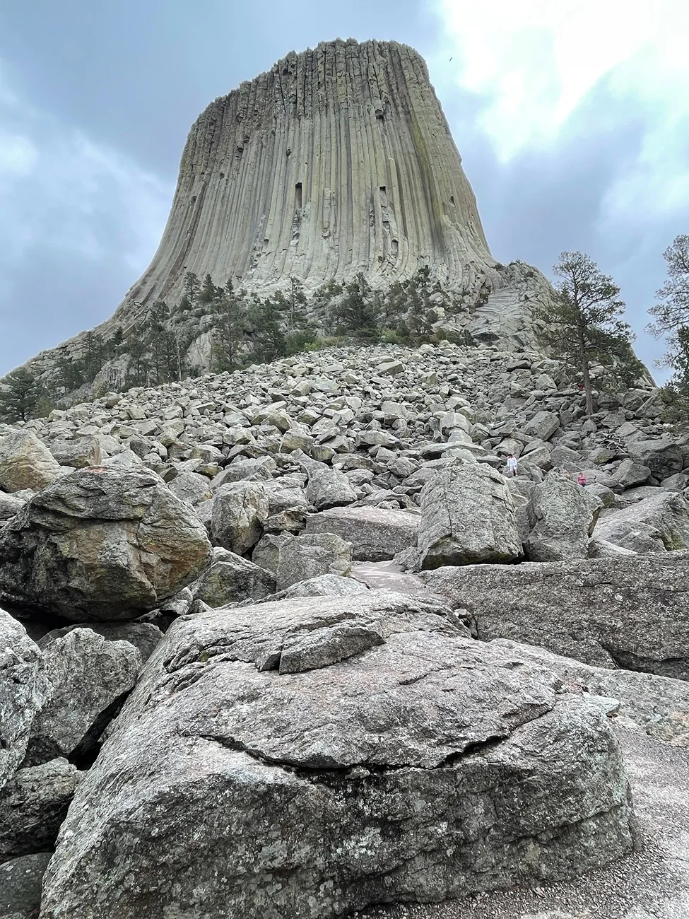
Devil’s Tower National Monument, Wyoming.
If you're into aircraft and you're going to Washington DC, Udvar-Hazy at Dulles airport is mind-blowing and a 150% must-see IMO ... it's WAYYY more impressive than the Smithsonian Aerospace - which itself is already impressive (but might still be in renovations)Washington DC; Smithsonian Natural History Museum & Aerospace Museum
Wow that's a nice list.Great trip...thanks for sharing - I do something similar...
Listed below with GPS coordinates.
Trailer is interesting - A local company makes an identical trailer - base trailer ranges
from $3,500 to $4,000 depending on shelving and if A/C unit is installed. Weighs in
at around 850 lbs.
The Big Bucket Travel List of Places to See
AZ- Barringer Crater, east of Flagstaff, AZ - 35.02773 111.02219
AZ- Tuson - Mount Lemmon in Santa Catalina Mountains -
AZ- Grand Canyon National Park - 36.28239 112.36437
AZ- Sedona, AZ city - 34.86102 111.81729
AZ- Hwy 180 from Grand Canyon to Flagstaff 36.26726 112.35351
AZ-Tombstone, Arizona - 31.71490 110.06981
AZ - Vermilon Cliffs - 36.88879 111.82831
NV-Death Valley National Park - 36.53526 117.09267
NV-Rhyolite Ghost Town - 36.89039 116.82652
NV-Red Rock Canyon – Sedona 35.38590 117.96219
NV-Valley of Fire State Park (50 miles North of Las Vegas) - 36.47617 114.53839
NV-Fly Geyser - 40.85947 119.33191
NV-Hoover Dam - 36.01632 114.73957
CA-17 Mile Drive - Pebble Beach - 36.60370 121.94526
CA-Sea to Sky highway, from Vancouver to Whistler Canada - 49.46063 123.23654
CA-Salton Sea/Slab City/Salvation Mountain - Calpatria, CA - 33.28184 115.96819
CA-Yosemite Cloud's Rest – 37.76895 119.48928
CA-Yosemite National Park – 37.86647 119.54565
CA-Redwood National Park – 44.40786 124.04790
CA-Mud Pots – Niland - 33.22283 115.59538
CA-Sequoia National Park - 36.49179 118.56648
CA-Sierra Nevada Mountains – Tioga_Pass - 37.66083 119.13928
CA-San Luis Opismo to Morrow Bay – Motel – 35.26990 120.67229
CA-Hearst's Castle - 35.65066 121.18626
CA-Alabama Hills - Lone Pine – 36.61027 118.10017
CA-Death Valley – 36.64518 117.03562
CA-Joshua Tree NP – 34.13538 116.30898
CA-Mojave National Preserve (needs spare gas) - 35.02195 115.48304
NM-Lincoln National Forest - 32.95211 105.44154
NM-Carlsbad Caverns National Park - 32.18152 104.54220
NM-Chama, New Mexico (Large elk population) - 36.89397 106.58263
NM-Valle Vadal (Carson National Forest) population of Elk in US - 36.7575 105.27019
NM-Royal Gorge bridge (amazing) - 38.46146 105.32506
NM-Whitesands Missile Range, white sand dunes - 32.78334 106.18303
SD-Badlands National Park - 43.85733 102.33490
SD-Black Hills - 44.01657 103.85651
SD-Mount Rushmore - 43.88042 103.45376
CO-Alpine Loop - 38.03428 107.30462
CO-Mesa Verde National Park - 37.18378 108.48818
CO-Telluride - 37.93696 107.81266
CO-Estes Park (Elk) - 40.37846 105.51765
CO-Rocky Mountain National Park - 40.34458 105.67943
CO-Glenwood Springs, Garden of the Gods, Pikes Peak, Flatiron, Gunnison, Steamboat Springs - 39.54770 107.32527
CO-Great Sand Dunes National Park – 37.76476 105.62289
CO-Black Canyon of the Gunnison Nat Pk-(go to bottom on narrow paved road) -38.57722 107.74135
GA-Stone Mountain
GA-City of Savannah (RiverStreet - walk street, at night)
GA-Tybee Island -
GA-Cumberland Island (have to take a boat ride to reach island to see horses)
NH-Flume Gorge, Franconia State Park - New Hampshire
NH-Mt Washington - New Hampshire
NH-Kangamangus Hwy through the White Mountains
NC-Blue Ridge Parkway (NC and TN) http://en.wikipedia.org/wiki/Blue_Ridge_Parkway
NC-"The Dragon/Deals Gap" US129 (TN, NC)
NC-The Outer Banks of North Carolina (50-80+ miles)
NC-Nantahala National Forest – NC
MT-Beartooth Highway - 44.97520 109.45572
MT-Glacier National Park (Going to the Sun Hwy) 48.76034 113.78733
MT-Upper Missouri Breaks (very hard to get to, dirt)
MT-Charles M. Russell Wildlife Refuse 47.70005 107.16723
MT-Lemhi Pass (MT and Idaho) 44.97530 113.44531
MT-Bannock (western ghost town) 44.81526 113.91493
ID-Gibbons Pass (ID and Montana) 45.74683 11391493
ID-From Lolo, MT west - Hwy 12 (east and west)
ID-Lolo Motoring Highway (122 miles off-road – very off-road) ??
ID-North Fork, North Fork of the Salmon Road (dirt) to the dead end (34 miles)
ID-Hells Canyon NRA – 44.97370 116.85817
OR-Crater Lake – 42.93213 122.16716
OR-Tillamook Air Museum - blimp hanger on the Pacific - 45.42088 123.80432
OR-Painted Hills; Mitchell - 44.66235 120.27348
OR-John Day River/Deschutes River, Painted Hills
OR-Crater Lake National Park - 42.91112 122.13795
OR-Lassen Volcanic National Park - 40.49532 121.42532
OR-Hells Canyon Scenic By-Way 44.97443 116.85924
OR-Cape Perpetua, Oregon -
OR-Vista House View overlook of Columbia River - 45.54180 122.24677
OR-Fort Clatsop(Astoria)Winter camp replica of Lewis & Clark fort - 46.13478 123.88037
OR-Cannon Beach – (Hay Stack Rock) - 45.89123 123.96123
OR-Hat Rock – Oregon side of Columbia River – 45.91761 119.17046
NW-The Cascades - BC, WA, OR, CA
WA/OR-Lewis and Clark State Park on the Columbia River
WA-The Hwy from Asotin Washington to Enterprise Oregon (Hwy 3) is a great ride.
WA-Mount Rainier National Park - 46-81619 121.70672
WA-Mount St Helen - 46.2624 122.25838
WA/OR-Columbia River is state line (Oregon & Washington) - 46.22065 109.02926
WA- Cape Disappointment and Lighthouse - 46.29968 124.06540
WA-Dayton, WA Patit Creek L&C Campsite memorial – 46.34556 117.93568
WA – Dayton, Patit Creek L&C Campsite – 46.34584 117.93593
UT-Arches/Canyonlands National Parks Moab - 38.61669 109.61946
UT-Cisco to Arches (ghost town) Hwy 128-favorite road (20 miles) - 38.97085 109.32111
UT-Goblin Valley State Park – 38.56999 110.70721
UT-San Rafaell Swell (unique curvey road) - 38.82472 110.67704
UT-Lake Canyon (needs full day and hiking) - 40.96082 111.66850
UT-Capital Reef National Park (needs full day and hiking) (big) 38.29165 111.26169
UT- Kanab – 37.04330 112.52445
UT- Gunsmoke Movie Set - 37.11827 112.38396
UT- Moki Dugway (on way to Monument Valley; scary) - 37.27589 109.93835
UT- Monument Valley (UT and AZ) - 37.00560 110.17180
UT-Valley of the Gods – (East Entrance) 37.23517 – 109.81346
UT- Canyons of the Escalante – 37.50821 111.51490
UT-Zion National Park (needs 2 days to hike) - 37.30052 113.03240
UT-Bryce Canyon – 37.68335 112.14182
UT-Kodachrome Basin State Park - 37.51848 111.99031
UT- Escalante Petrified Forest – 37.78433 111.63110
UT- Ship Rock - 36.78203 108.64775
UT-Four Corners - 37.00185 109.05152
UT-Capital Reef - 38.10173 111.26225
UT-Mexican Hat - 37.15104 109.85906
UT-Grand Escalante Natl Monument - 37.50821 111.51490
UT- Escalate Petrified Forest - 37.78433 111.63110
UT-Valley of the Gods - 37.26796 109.83418
WY-Grand Tetons National Park (top 10)
WY-Yellowstone Park – 43.833333 110.700833
WY-Jackson Hole - 43.61582 110.72244
WY - Pinedale and Afton, WY (towards Jackson, WY) 42.72774 110.93023
WY-Chief Joseph Scenic Highway- 44.72806 109.23158
WY-Lady in the Tub Rock – 37.27876 109.86464
WY-Devils Tower – remote - 44.59076 104.69948
TX-Big Bend NP
NE-North Platte (worlds largest train yard) - 42.14228 102.85795
VT-Route 100
KS - Cawker City – Largest ball of sisal twine in the world - 39.50930 98.43368
MA-Bar Harbor/Calander Islands, Maine
VA-Foamhenge
Washington DC; Smithsonian Natural History Museum & Aerospace Museum
Canada - Vancover Island
Canada- Icefields Parkway - http://en.wikipedia.org/wiki/Icefields_Parkway
Canada - Waterton National Park Hotel – Prince of Wales Hotel 49.06295 113.90484
Canada - Lake Louise (beautiful) - 51.41747 116.21759

I had read where there were warm blooded creatures up there without wings! I once hunted just east of The Tower, with my archery tree stand facing it in full view. As it started to dusk, the coyotes that started screaming and howling and yipping gave me goosebumps!! There were literally hundreds of them, if not thousands within earshot!Good friend climbed Devil's Tower several years ago. He got a surprise when he reached the top. A variety of birds captured squirrels, prairie dogs, mice, rats, etc and flew to the top of Devil's Tower to eat their catch....my friend said there were all kinds of manuals on the top of Devils Tower that had escaped and could not get down.
 That and the unobstructed view of the tower made a lasting impression in my brain I will never forget!!
Great trip...thanks for sharing - I do something similar...
Listed below with GPS coordinates.
Trailer is interesting - A local company makes an identical trailer - base trailer ranges
from $3,500 to $4,000 depending on shelving and if A/C unit is installed. Weighs in
at around 850 lbs.
The Big Bucket Travel List of Places to See
AZ- Barringer Crater, east of Flagstaff, AZ - 35.02773 111.02219
AZ- Tuson - Mount Lemmon in Santa Catalina Mountains -
AZ- Grand Canyon National Park - 36.28239 112.36437
AZ- Sedona, AZ city - 34.86102 111.81729
AZ- Hwy 180 from Grand Canyon to Flagstaff 36.26726 112.35351
AZ-Tombstone, Arizona - 31.71490 110.06981
AZ - Vermilon Cliffs - 36.88879 111.82831
NV-Death Valley National Park - 36.53526 117.09267
NV-Rhyolite Ghost Town - 36.89039 116.82652
NV-Red Rock Canyon – Sedona 35.38590 117.96219
NV-Valley of Fire State Park (50 miles North of Las Vegas) - 36.47617 114.53839
NV-Fly Geyser - 40.85947 119.33191
NV-Hoover Dam - 36.01632 114.73957
CA-17 Mile Drive - Pebble Beach - 36.60370 121.94526
CA-Sea to Sky highway, from Vancouver to Whistler Canada - 49.46063 123.23654
CA-Salton Sea/Slab City/Salvation Mountain - Calpatria, CA - 33.28184 115.96819
CA-Yosemite Cloud's Rest – 37.76895 119.48928
CA-Yosemite National Park – 37.86647 119.54565
CA-Redwood National Park – 44.40786 124.04790
CA-Mud Pots – Niland - 33.22283 115.59538
CA-Sequoia National Park - 36.49179 118.56648
CA-Sierra Nevada Mountains – Tioga_Pass - 37.66083 119.13928
CA-San Luis Opismo to Morrow Bay – Motel – 35.26990 120.67229
CA-Hearst's Castle - 35.65066 121.18626
CA-Alabama Hills - Lone Pine – 36.61027 118.10017
CA-Death Valley – 36.64518 117.03562
CA-Joshua Tree NP – 34.13538 116.30898
CA-Mojave National Preserve (needs spare gas) - 35.02195 115.48304
NM-Lincoln National Forest - 32.95211 105.44154
NM-Carlsbad Caverns National Park - 32.18152 104.54220
NM-Chama, New Mexico (Large elk population) - 36.89397 106.58263
NM-Valle Vadal (Carson National Forest) population of Elk in US - 36.7575 105.27019
NM-Royal Gorge bridge (amazing) - 38.46146 105.32506
NM-Whitesands Missile Range, white sand dunes - 32.78334 106.18303
SD-Badlands National Park - 43.85733 102.33490
SD-Black Hills - 44.01657 103.85651
SD-Mount Rushmore - 43.88042 103.45376
CO-Alpine Loop - 38.03428 107.30462
CO-Mesa Verde National Park - 37.18378 108.48818
CO-Telluride - 37.93696 107.81266
CO-Estes Park (Elk) - 40.37846 105.51765
CO-Rocky Mountain National Park - 40.34458 105.67943
CO-Glenwood Springs, Garden of the Gods, Pikes Peak, Flatiron, Gunnison, Steamboat Springs - 39.54770 107.32527
CO-Great Sand Dunes National Park – 37.76476 105.62289
CO-Black Canyon of the Gunnison Nat Pk-(go to bottom on narrow paved road) -38.57722 107.74135
GA-Stone Mountain
GA-City of Savannah (RiverStreet - walk street, at night)
GA-Tybee Island -
GA-Cumberland Island (have to take a boat ride to reach island to see horses)
NH-Flume Gorge, Franconia State Park - New Hampshire
NH-Mt Washington - New Hampshire
NH-Kangamangus Hwy through the White Mountains
NC-Blue Ridge Parkway (NC and TN) http://en.wikipedia.org/wiki/Blue_Ridge_Parkway
NC-"The Dragon/Deals Gap" US129 (TN, NC)
NC-The Outer Banks of North Carolina (50-80+ miles)
NC-Nantahala National Forest – NC
MT-Beartooth Highway - 44.97520 109.45572
MT-Glacier National Park (Going to the Sun Hwy) 48.76034 113.78733
MT-Upper Missouri Breaks (very hard to get to, dirt)
MT-Charles M. Russell Wildlife Refuse 47.70005 107.16723
MT-Lemhi Pass (MT and Idaho) 44.97530 113.44531
MT-Bannock (western ghost town) 44.81526 113.91493
ID-Gibbons Pass (ID and Montana) 45.74683 11391493
ID-From Lolo, MT west - Hwy 12 (east and west)
ID-Lolo Motoring Highway (122 miles off-road – very off-road) ??
ID-North Fork, North Fork of the Salmon Road (dirt) to the dead end (34 miles)
ID-Hells Canyon NRA – 44.97370 116.85817
OR-Crater Lake – 42.93213 122.16716
OR-Tillamook Air Museum - blimp hanger on the Pacific - 45.42088 123.80432
OR-Painted Hills; Mitchell - 44.66235 120.27348
OR-John Day River/Deschutes River, Painted Hills
OR-Crater Lake National Park - 42.91112 122.13795
OR-Lassen Volcanic National Park - 40.49532 121.42532
OR-Hells Canyon Scenic By-Way 44.97443 116.85924
OR-Cape Perpetua, Oregon -
OR-Vista House View overlook of Columbia River - 45.54180 122.24677
OR-Fort Clatsop(Astoria)Winter camp replica of Lewis & Clark fort - 46.13478 123.88037
OR-Cannon Beach – (Hay Stack Rock) - 45.89123 123.96123
OR-Hat Rock – Oregon side of Columbia River – 45.91761 119.17046
NW-The Cascades - BC, WA, OR, CA
WA/OR-Lewis and Clark State Park on the Columbia River
WA-The Hwy from Asotin Washington to Enterprise Oregon (Hwy 3) is a great ride.
WA-Mount Rainier National Park - 46-81619 121.70672
WA-Mount St Helen - 46.2624 122.25838
WA/OR-Columbia River is state line (Oregon & Washington) - 46.22065 109.02926
WA- Cape Disappointment and Lighthouse - 46.29968 124.06540
WA-Dayton, WA Patit Creek L&C Campsite memorial – 46.34556 117.93568
WA – Dayton, Patit Creek L&C Campsite – 46.34584 117.93593
UT-Arches/Canyonlands National Parks Moab - 38.61669 109.61946
UT-Cisco to Arches (ghost town) Hwy 128-favorite road (20 miles) - 38.97085 109.32111
UT-Goblin Valley State Park – 38.56999 110.70721
UT-San Rafaell Swell (unique curvey road) - 38.82472 110.67704
UT-Lake Canyon (needs full day and hiking) - 40.96082 111.66850
UT-Capital Reef National Park (needs full day and hiking) (big) 38.29165 111.26169
UT- Kanab – 37.04330 112.52445
UT- Gunsmoke Movie Set - 37.11827 112.38396
UT- Moki Dugway (on way to Monument Valley; scary) - 37.27589 109.93835
UT- Monument Valley (UT and AZ) - 37.00560 110.17180
UT-Valley of the Gods – (East Entrance) 37.23517 – 109.81346
UT- Canyons of the Escalante – 37.50821 111.51490
UT-Zion National Park (needs 2 days to hike) - 37.30052 113.03240
UT-Bryce Canyon – 37.68335 112.14182
UT-Kodachrome Basin State Park - 37.51848 111.99031
UT- Escalante Petrified Forest – 37.78433 111.63110
UT- Ship Rock - 36.78203 108.64775
UT-Four Corners - 37.00185 109.05152
UT-Capital Reef - 38.10173 111.26225
UT-Mexican Hat - 37.15104 109.85906
UT-Grand Escalante Natl Monument - 37.50821 111.51490
UT- Escalate Petrified Forest - 37.78433 111.63110
UT-Valley of the Gods - 37.26796 109.83418
WY-Grand Tetons National Park (top 10)
WY-Yellowstone Park – 43.833333 110.700833
WY-Jackson Hole - 43.61582 110.72244
WY - Pinedale and Afton, WY (towards Jackson, WY) 42.72774 110.93023
WY-Chief Joseph Scenic Highway- 44.72806 109.23158
WY-Lady in the Tub Rock – 37.27876 109.86464
WY-Devils Tower – remote - 44.59076 104.69948
TX-Big Bend NP
NE-North Platte (worlds largest train yard) - 42.14228 102.85795
VT-Route 100
KS - Cawker City – Largest ball of sisal twine in the world - 39.50930 98.43368
MA-Bar Harbor/Calander Islands, Maine
VA-Foamhenge
Washington DC; Smithsonian Natural History Museum & Aerospace Museum
Canada - Vancover Island
Canada- Icefields Parkway - http://en.wikipedia.org/wiki/Icefields_Parkway
Canada - Waterton National Park Hotel – Prince of Wales Hotel 49.06295 113.90484
Canada - Lake Louise (beautiful) - 51.41747 116.21759
So, Edge, you have already recorded all those coordinates listed above with your physical presence? If so, that is a very well travelled resume!! This trip I am posting about is a small sampling of the places I have seen in North, Central and South America and the Carribean. So wonderful to discover new places. It never gets old with me!!!Great trip...thanks for sharing - I do something similar...
Listed below with GPS coordinates.
Trailer is interesting - A local company makes an identical trailer - base trailer ranges
from $3,500 to $4,000 depending on shelving and if A/C unit is installed. Weighs in
at around 850 lbs.
The Big Bucket Travel List of Places to See
AZ- Barringer Crater, east of Flagstaff, AZ - 35.02773 111.02219
AZ- Tuson - Mount Lemmon in Santa Catalina Mountains -
AZ- Grand Canyon National Park - 36.28239 112.36437
AZ- Sedona, AZ city - 34.86102 111.81729
AZ- Hwy 180 from Grand Canyon to Flagstaff 36.26726 112.35351
AZ-Tombstone, Arizona - 31.71490 110.06981
AZ - Vermilon Cliffs - 36.88879 111.82831
NV-Death Valley National Park - 36.53526 117.09267
NV-Rhyolite Ghost Town - 36.89039 116.82652
NV-Red Rock Canyon – Sedona 35.38590 117.96219
NV-Valley of Fire State Park (50 miles North of Las Vegas) - 36.47617 114.53839
NV-Fly Geyser - 40.85947 119.33191
NV-Hoover Dam - 36.01632 114.73957
CA-17 Mile Drive - Pebble Beach - 36.60370 121.94526
CA-Sea to Sky highway, from Vancouver to Whistler Canada - 49.46063 123.23654
CA-Salton Sea/Slab City/Salvation Mountain - Calpatria, CA - 33.28184 115.96819
CA-Yosemite Cloud's Rest – 37.76895 119.48928
CA-Yosemite National Park – 37.86647 119.54565
CA-Redwood National Park – 44.40786 124.04790
CA-Mud Pots – Niland - 33.22283 115.59538
CA-Sequoia National Park - 36.49179 118.56648
CA-Sierra Nevada Mountains – Tioga_Pass - 37.66083 119.13928
CA-San Luis Opismo to Morrow Bay – Motel – 35.26990 120.67229
CA-Hearst's Castle - 35.65066 121.18626
CA-Alabama Hills - Lone Pine – 36.61027 118.10017
CA-Death Valley – 36.64518 117.03562
CA-Joshua Tree NP – 34.13538 116.30898
CA-Mojave National Preserve (needs spare gas) - 35.02195 115.48304
NM-Lincoln National Forest - 32.95211 105.44154
NM-Carlsbad Caverns National Park - 32.18152 104.54220
NM-Chama, New Mexico (Large elk population) - 36.89397 106.58263
NM-Valle Vadal (Carson National Forest) population of Elk in US - 36.7575 105.27019
NM-Royal Gorge bridge (amazing) - 38.46146 105.32506
NM-Whitesands Missile Range, white sand dunes - 32.78334 106.18303
SD-Badlands National Park - 43.85733 102.33490
SD-Black Hills - 44.01657 103.85651
SD-Mount Rushmore - 43.88042 103.45376
CO-Alpine Loop - 38.03428 107.30462
CO-Mesa Verde National Park - 37.18378 108.48818
CO-Telluride - 37.93696 107.81266
CO-Estes Park (Elk) - 40.37846 105.51765
CO-Rocky Mountain National Park - 40.34458 105.67943
CO-Glenwood Springs, Garden of the Gods, Pikes Peak, Flatiron, Gunnison, Steamboat Springs - 39.54770 107.32527
CO-Great Sand Dunes National Park – 37.76476 105.62289
CO-Black Canyon of the Gunnison Nat Pk-(go to bottom on narrow paved road) -38.57722 107.74135
GA-Stone Mountain
GA-City of Savannah (RiverStreet - walk street, at night)
GA-Tybee Island -
GA-Cumberland Island (have to take a boat ride to reach island to see horses)
NH-Flume Gorge, Franconia State Park - New Hampshire
NH-Mt Washington - New Hampshire
NH-Kangamangus Hwy through the White Mountains
NC-Blue Ridge Parkway (NC and TN) http://en.wikipedia.org/wiki/Blue_Ridge_Parkway
NC-"The Dragon/Deals Gap" US129 (TN, NC)
NC-The Outer Banks of North Carolina (50-80+ miles)
NC-Nantahala National Forest – NC
MT-Beartooth Highway - 44.97520 109.45572
MT-Glacier National Park (Going to the Sun Hwy) 48.76034 113.78733
MT-Upper Missouri Breaks (very hard to get to, dirt)
MT-Charles M. Russell Wildlife Refuse 47.70005 107.16723
MT-Lemhi Pass (MT and Idaho) 44.97530 113.44531
MT-Bannock (western ghost town) 44.81526 113.91493
ID-Gibbons Pass (ID and Montana) 45.74683 11391493
ID-From Lolo, MT west - Hwy 12 (east and west)
ID-Lolo Motoring Highway (122 miles off-road – very off-road) ??
ID-North Fork, North Fork of the Salmon Road (dirt) to the dead end (34 miles)
ID-Hells Canyon NRA – 44.97370 116.85817
OR-Crater Lake – 42.93213 122.16716
OR-Tillamook Air Museum - blimp hanger on the Pacific - 45.42088 123.80432
OR-Painted Hills; Mitchell - 44.66235 120.27348
OR-John Day River/Deschutes River, Painted Hills
OR-Crater Lake National Park - 42.91112 122.13795
OR-Lassen Volcanic National Park - 40.49532 121.42532
OR-Hells Canyon Scenic By-Way 44.97443 116.85924
OR-Cape Perpetua, Oregon -
OR-Vista House View overlook of Columbia River - 45.54180 122.24677
OR-Fort Clatsop(Astoria)Winter camp replica of Lewis & Clark fort - 46.13478 123.88037
OR-Cannon Beach – (Hay Stack Rock) - 45.89123 123.96123
OR-Hat Rock – Oregon side of Columbia River – 45.91761 119.17046
NW-The Cascades - BC, WA, OR, CA
WA/OR-Lewis and Clark State Park on the Columbia River
WA-The Hwy from Asotin Washington to Enterprise Oregon (Hwy 3) is a great ride.
WA-Mount Rainier National Park - 46-81619 121.70672
WA-Mount St Helen - 46.2624 122.25838
WA/OR-Columbia River is state line (Oregon & Washington) - 46.22065 109.02926
WA- Cape Disappointment and Lighthouse - 46.29968 124.06540
WA-Dayton, WA Patit Creek L&C Campsite memorial – 46.34556 117.93568
WA – Dayton, Patit Creek L&C Campsite – 46.34584 117.93593
UT-Arches/Canyonlands National Parks Moab - 38.61669 109.61946
UT-Cisco to Arches (ghost town) Hwy 128-favorite road (20 miles) - 38.97085 109.32111
UT-Goblin Valley State Park – 38.56999 110.70721
UT-San Rafaell Swell (unique curvey road) - 38.82472 110.67704
UT-Lake Canyon (needs full day and hiking) - 40.96082 111.66850
UT-Capital Reef National Park (needs full day and hiking) (big) 38.29165 111.26169
UT- Kanab – 37.04330 112.52445
UT- Gunsmoke Movie Set - 37.11827 112.38396
UT- Moki Dugway (on way to Monument Valley; scary) - 37.27589 109.93835
UT- Monument Valley (UT and AZ) - 37.00560 110.17180
UT-Valley of the Gods – (East Entrance) 37.23517 – 109.81346
UT- Canyons of the Escalante – 37.50821 111.51490
UT-Zion National Park (needs 2 days to hike) - 37.30052 113.03240
UT-Bryce Canyon – 37.68335 112.14182
UT-Kodachrome Basin State Park - 37.51848 111.99031
UT- Escalante Petrified Forest – 37.78433 111.63110
UT- Ship Rock - 36.78203 108.64775
UT-Four Corners - 37.00185 109.05152
UT-Capital Reef - 38.10173 111.26225
UT-Mexican Hat - 37.15104 109.85906
UT-Grand Escalante Natl Monument - 37.50821 111.51490
UT- Escalate Petrified Forest - 37.78433 111.63110
UT-Valley of the Gods - 37.26796 109.83418
WY-Grand Tetons National Park (top 10)
WY-Yellowstone Park – 43.833333 110.700833
WY-Jackson Hole - 43.61582 110.72244
WY - Pinedale and Afton, WY (towards Jackson, WY) 42.72774 110.93023
WY-Chief Joseph Scenic Highway- 44.72806 109.23158
WY-Lady in the Tub Rock – 37.27876 109.86464
WY-Devils Tower – remote - 44.59076 104.69948
TX-Big Bend NP
NE-North Platte (worlds largest train yard) - 42.14228 102.85795
VT-Route 100
KS - Cawker City – Largest ball of sisal twine in the world - 39.50930 98.43368
MA-Bar Harbor/Calander Islands, Maine
VA-Foamhenge
Washington DC; Smithsonian Natural History Museum & Aerospace Museum
Canada - Vancover Island
Canada- Icefields Parkway - http://en.wikipedia.org/wiki/Icefields_Parkway
Canada - Waterton National Park Hotel – Prince of Wales Hotel 49.06295 113.90484
Canada - Lake Louise (beautiful) - 51.41747 116.21759
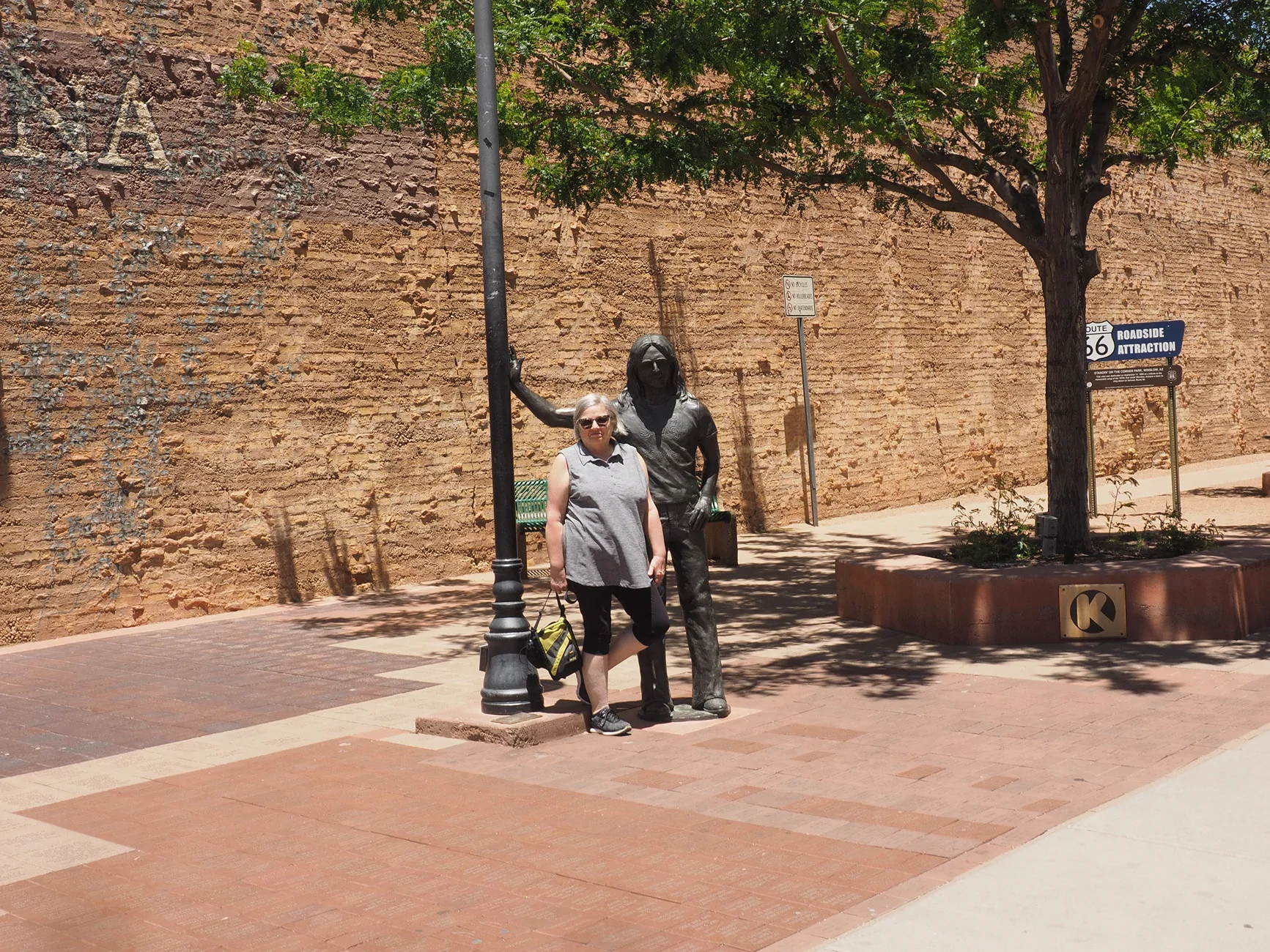
Cathy needs to get photos every trip to AZ now!Wow that's a nice list.
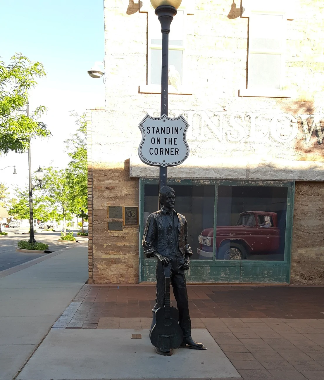
While you're going to the crater in Arizona don't forget to stand around on the corner in Winslow Arizona.
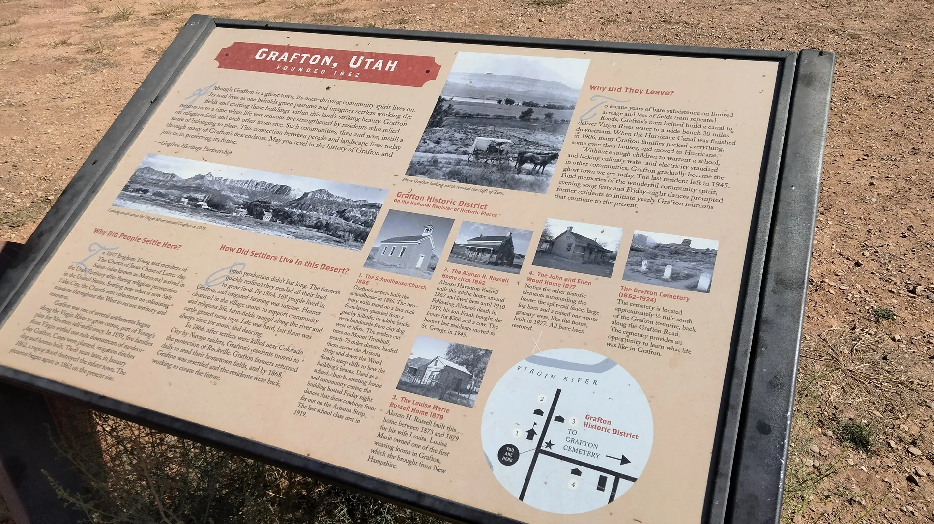
I don't know if you're a fan of the movie Butch Cassidy and the Sundance Kid movie? If you are and I saw Zion National Park on your list on your way through Springdale if you make a right turn in town you can take the road to Grafton where they filmed Butch Cassidy in the Sundance Kid some of the buildings are still in existence from the movie.
I've been to Mesa Verde also Black Canyon of the Gunnison. While you're in that area of Colorado. The town of Ridgway where they filmed True Grit with John Wayne. You'll be pretty close to Deb's Meadow where they film the climatic shootout scene.
I also noticed you had Glenwood Springs and Pikes Peak. While you're near Glenwood Springs. Glenwood Springs claims to have Doc Holliday's grave. ( although rumor has it. He was moved to Savannah Georgia)
If you're heading towards Denver thru Idaho Springs on I-70 you could head up to Mount Evans. Now called Mount Blue Sky It's a little taller than Pikes Peak. it is the highest paved highway in the United States.
About an hour outside of Yellowstone
More pictures please!!
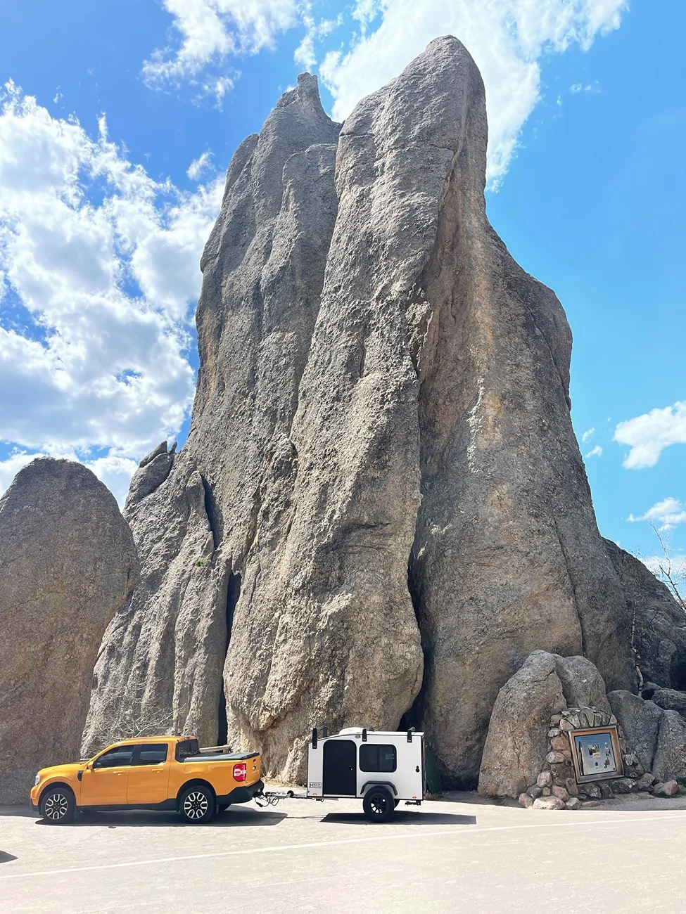
Custer State Park, Black Hills, South Dakota. Staging area for the ‘Needles Eye Tunnel.’